Hey Guys!
If you are keeping up with my blog posts you will know that we are actually doing day 4 of our itinerary due to our flight out to Iceland being cancelled.
You can see my full itinerary here along with tons of useful tips and information!
You can see Day 1 of our trip here, Day 2 here, Day 4 here, Day 5 here, Day 6 here & Day 7 here…..Read my blog post here about all the churches that we visited in Iceland!
Ok, lets get started.
We are now in Eglisstadir and will be making the drive to Husavik. (140 miles)
Tip: You’ll have seen plenty of sheep and horses by this point on your trip, but if you look closely, you may see reindeer roaming in the area around Egilsstaðir.
We started our morning out with the well known Icelandic Skyr that our host had left for us in our cabin… I’ll have to admit that I wasn’t a fan. 🙁

After leaving our much loved cabin at the Kalda Lyngholt Holiday Homes, we stopped off to take a few shots of those beautiful Icelandic horses!

We then headed to our first stop of the day, the beautiful and modern looking church, Egilsstadakirkja. (you could add this to yesterday’s itinerary if time permits). There is also another church in Egilsstadir called Askirkja.
Tip: If you have time, you could drive 50 mins on road 94 to Stórurð…this would require you to backtrack to Eglisstadir to get on Ring Road 1. This hikes take approx. 4-6 hrs round trip or drive 50 mins on Route 95 to the Wilderness Center and Cable Car
Read more about Eglisstadir here.
The Eglisstadakirkja Church


Lagarfljót Lake is nearby so you could make it your first stop if you wanted. Read about the lake worm in this lake here. 😉 You can also make a stop at the waterfall Fardagafoss. (12 mins from our hotel)
Tip: 20 mins from Eglisstadir is the Hallormsstadur National Forest – It’s Iceland’s largest forest -The forest covers an area of 740 hectares most of which is native birch. Click here for the top things to see in Eglisstadir.
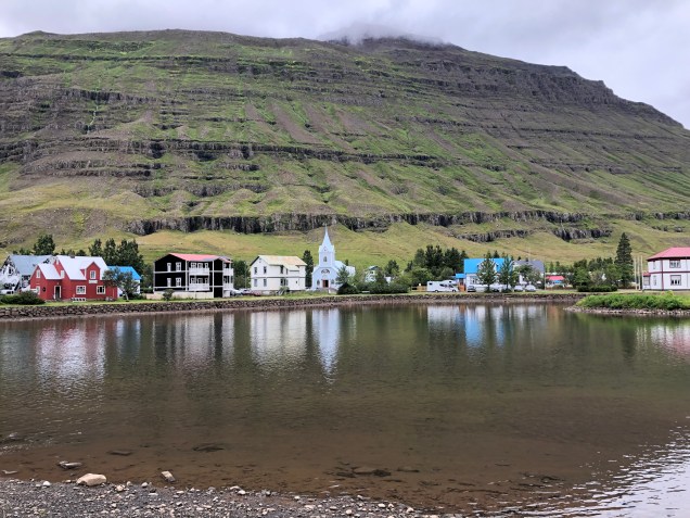
After leaving the church, we headed to our next stop, which was on yesterday’s itinerary but due to time constraints, we added it to today’s itinerary. It was the beautiful town of Seydisfjordur.
I highly recommend a stop here…the drive to Seydisfjordur is steep and curvy but the road is all paved…and the views were awesome!

We made a few stops along the way.


We stopped off at the waterfall, Gufufoss. It’s located approximately 5 miles from Seydisfjordur.


Seydisfjordur was one of our favorite towns we visited. It was so quaint and had so many colorful buildings. We loved the little blue church with the colorful path leading to it!


We walked into one of the many shops and my hubby just had to buy one of the wool hats! I loved all the beautiful wool sweaters but they were so expensive. I just couldn’t make myself pay $200+ on a sweater that I may never wear again!

More shots of this colorful town!


Tip: While you are here, you can also check out Tvisongnor & the old phone booth built into the side of a mountain or take a boat tour. Click here for everything to see & do in Seydisfjordur
After leaving Seydisfjordur, we headed to our next stop.
However, to get there, we had to backtrack 30 mins to Egillistadir.
Once we arrived back to Egillistadir, we decided to stop off at a nearby gas station for one of those famous Icelandic hotdogs!

After lunch, we headed to our next stop.
We had initially planned on hiking to Hengifoss but since it’s a 2 hr roundtrip hike, we decided to skip it and move on to our next stop which was Dettifoss & Selfoss.
These waterfalls are located approx 2 1/2 hrs from Seydisfjordur & 2 hrs from Eglisstadir.
Tip: On your way to Dettifoss (west side), I recommend you stop at the Stuðlagil basalt canyon. It’s located 1 hr from Eglisstadir – Do Not Miss this stop!!
We stopped off at this bridge on our drive to Dettifoss..It looked like a nice place for a picnic. There was also a bathroom located here.


We also stopped off at this roadside waterfall for a quick shot. I can’t remember the name. I took a picture of the sign but can’t make it out! 🙁


Click here for more waterfalls in this area and here for hiking trails.
We spotted this random white chair sitting at a pull off…..of course, we had to stop! 😉


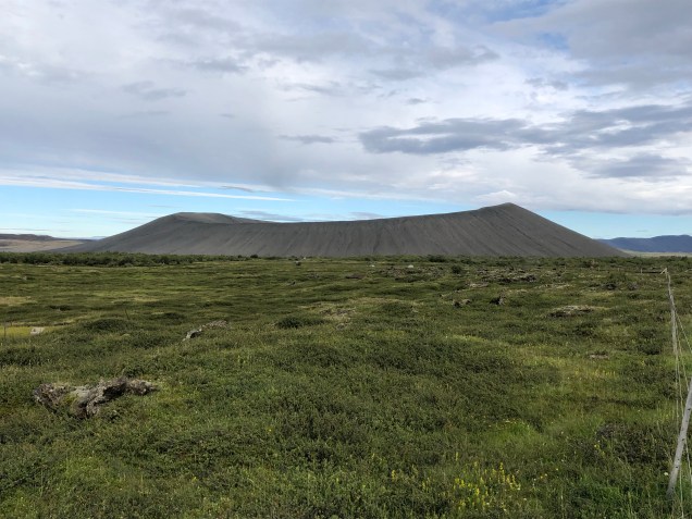
The scenery looked like you were on Mars!


We crossed this one way bridge on our drive. It was located in Norðurþing. You will cross many one way bridges along the ring road.

As we turned on Road 862 heading towards Dettifoss, we saw a huge lava field so we pulled over to take a closer look…it was amazing!


We finally arrived to the very busy Dettifoss! It was about a 15 min walk to the waterfall.
Dettifoss has the greatest volume of any water fall in Europe. It’s 148 ft high and 328 ft wide and was incredible!! This is definitely a must stop!
There are 2 routes to this waterfall, Road 864 (20 mi on a gravel road..it’s the first road you will come to & is the East side) & Road 862 (West side – 15 mi on a paved road). Selfoss can be accessed from both sides but if you go to the East side, you will have a much further walk to Selfoss.
From the West side, it’s about a 15-20 min walk to Dettifoss & the same for Selfoss. From the East side it’s a much further walk to Selfoss and it’s through a very rocky path.
The road leading to the East side is gravel and not in the best shape. It’s also closed during the winter. Read more here & here.
The trail to Dettifoss


Dettifoss was amazing!


Make sure you walk another 15 mins to see Selfoss!

Tip: If time permits, You can also see the waterfall, Hafragilsfoss it’s 10 mins from Dettifoss from the East Side on Rd 864– it’s 1 hr 15 mins from the West side on Rd 862
Tip: If you go to Hafragilsfoss you could also do Vesturdalur – this is 45 mins from Hafragilsfoss if you are on the East Side and 45 mins from West side on Rd 862 –we didn’t do this because it was on a long gravel road that was mostly suitable for 4WD. Check out Asbyrgi in this area – 35 mins from Hafragilsfoss from East & 1 hr from West.. Read more here.
Tip: Your next stop could be Asbyrgi Canyon – it’s 30 mins from Dettifoss and located within the Vatnajokull National Park.
After leaving this area, we began our drive to our next stops..these stops are all within very close proximity to one another.
You will first come to the Krafla Visitor Center. (look for the random sink & shower on the side of the road)
At the visitors center, you can find out about its history and the harnessing of geothermal energy for electricity production. We didn’t stop but you will drive through this area to get to the next stop which is the Leirhnjukur Lava Fields.
The Krafla Power Plant


At Leirhnjukur, you will not only see lava fields but a whole lot more!


Amazing!


The scenery was unreal!

Your next stop will be the Viti Crater.
It’s definitely worth the walk..the views were awesome! You can walk the entire rim of the crater…we didn’t realize that there were other things to see about 1/2 way around the crater until we got home and saw an aerial shot of it!
This crater, which was formed from an eruption in the early 1700s, now holds a bright blue lake.


Next stop will be Hverir & Hverarond. This is Lake Myvatns geothermal area where you will find bubbling mud pools, smoking fumaroles and hot vents! Do not miss this area!
Click here for everything there is to see and do in Lake Myvatn


Your next stop will be the Myvatn Nature Baths but we skipped this. Purchase tickets here & read reviews here.
We then headed to our next stop, Grjotagja Cave. You will see the parking very near the road and the cave is just a few feet from the parking area.
Icelanders have been bathing in this cave for centuries. It was closed during the 1970s when nearby volcanic eruptions caused the water temperature to rise making it too hot to soak in.
If you’re a fan of HBO’s Game of Thrones, then you may recognize this spot as the love cave shared by Jon Snow and Ygritte.
There were several people here. I just walked down into the cave & took a few pictures.


Also, located near here is the Storagja Canyon & Cave . This is another cave you can swim in but I’ve read that not only is it dangerous to get to but it is full of ecoli bacteria! No thanks!
Tip: A nearby hike called the Myvatn Scenic Loop – hike starts in Reykjahlio which is very close to the Storagja Cave stop.
Our next stop was Hverfjall where you can walk the rim of the crater from the parking lot at Hverfell. It takes about 20 mins to walk it but we skipped this stop.
Our next stop was the Dimmuborgi lava formations….sadly, it wouldn’t pull up on my Maps.me app so we had to skip it. 🙁
We did, however, stumble upon an awesome restaurant called Vogafjos Cafe…we had the most amazing burgers there!! It’s attached to the Vogafjos Farm Guesthouse. I highly recommend a stop here!
This restaurant is similar to Efstidalur II which is on the Golden Circle drive…it’s where you can sit and eat your meal while watching the cows….such a neat experience!


After leaving here we headed to our next stop, Hofdi ..but again, our Maps.me app wouldn’t pull it up…I was disappointed that we couldn’t find it as I had really wanted to see this area! 🙁
We stopped and took some pictures of Lake Myvatn…it was beautiful!

Tip: There are lots of flies in this area!!
We spotted another church so, of course, we had to stop! It was called Reykjahlid Church.


Click here for other things to see and do in this area.
We also spotted this near the road. It was called Hlidarrett. It’s an old sheepfold that was built in 1880.


We then headed to our hotel in Husavik, called Fosshotel Husavik. It was a very nice, modern hotel. The cost was $245.
We went down a very long gravel road on the way to our hotel! 🙁

We finally arrived ..we loved this hotel! The location was great!


The lobby was so cool!


The view from our balcony

After checking into our hotel, we decided to go check out the small town of Húsavík.
We loved this beautiful church!

Húsavík has a cute little harbor…this place is most known for their whale watching. Book a tour here. Read about about other things do here.


Tip: Near our hotel there is a placed called Tjornes with an observation deck at Hringsbjark that is good for spotting Puffins…we tried to find it but couldn’t. Read more about it here.
Tip: Don’t miss the GeoSea Geothermal Sea Baths in Husavik! Read reviews here.
This concludes our 3rd day in Iceland. Thanks for reading..and stay tuned for day 4!
Here is your route on the map:
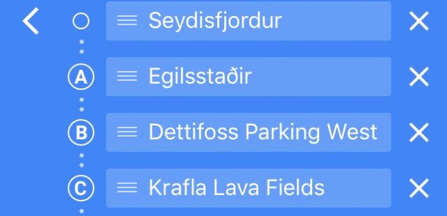
Here is your route on the Google Maps App:


2 thoughts on “Day 3 of 7 on the Ring Road in Iceland”