Hey Guys!
If you are keeping up with my blog posts, you will know that we are actually doing day 6 of our itinerary.
Due to our flight out to Iceland being cancelled and not being rescheduled until the next day, it caused us to start with day 2 of our itinerary. We ended up doing day 1 of our itinerary on day 7.
Click here to read my full itinerary & TONS of useful information, Click here for Day 1, here for Day 2, here for Day 3 & here for Day 4, here for Day 6, Day 7 here & click here to read my blog on the churches we visited in Iceland.
Before I get started – this is where you could also head to the Westfjords if you wanted to see that part of Iceland. But please be aware that the Westfjords are really only accessible in the summer months, from May to October as snowfall is heavy in this region, and due to the small population, the roads are not as regularly maintained as in the rest of the country.
The West Fjords is where you will find the incredible waterfall called Dynjandi...this waterfall is located approx. 4 hrs from the closest Hvammstangi.…read all about this part of Iceland here.
So, let’s get started.
We are now in Hvammstangi making our way to Langaholt in the Snaefellsnes Peninsula. It’s a 2 ½ hr drive without our stops.
After checking out of our guesthouse, the Gauksmyri Lodge, we headed to our first stop of the day. It was a waterfall 15 mins from our hotel called Koluglufur.
We really enjoyed this waterfall and I would definitely recommend a stop here if you are in the area. It’s very close to the road so no hiking involved.
The river that runs through it is full of salmon during the summer however, we never saw any.


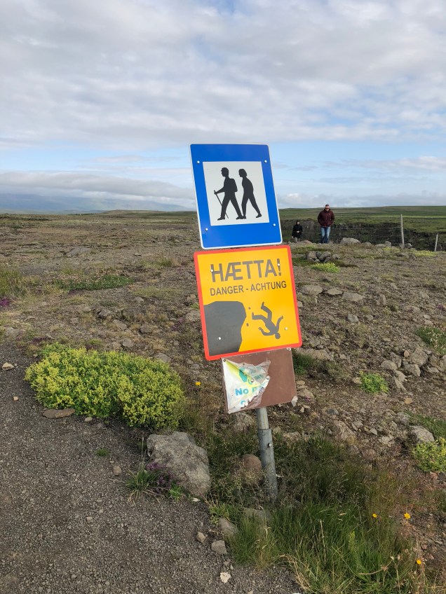
Tip: The Icelandic Tourist Bureau has listed Kolugljufur as one of the ten most dangerous tourist spots in Iceland. Read more here.
After leaving here, we headed to our next stop of the day, Stykkisholmur which is 2 ½ hrs from Koluglufur.
We stopped off at this church called Melstadur along the way.


We had to drive one of those dreadful gravel roads on the way! 
We saw so many abandoned farms and buildings in Iceland!

We spotted this on our drive and made a quick stop to take some pics.. It was called Skrauma.
The Lupine flowers were blooming all over!


Look how clear the water was!


The gravel road seemed endless!

We spotted this cute little church sitting next to the water!!

I took so many pictures on the drive to Stykkisholmur! The views were just amazing!


Potholes the size of Texas!! I hated the gravel roads…I just knew any minute we would blow a tire! It didn’t help that we were in a car the size of a matchbox!

After a very long drive, we finally arrived to Stykkisholmur. Our first stop was at the very modern looking church called Stykkisholmskirkja.
The futuristic church, designed by Jón Haraldsson, has a sweeping bell tower that looks like a whale vertebra. The interior features hundreds of suspended lights and a painting of the Madonna and child floating in the night sky.


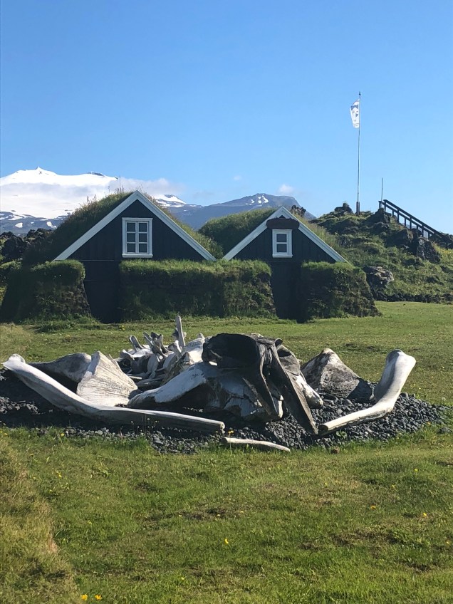
I highly recommend a stop in Stykkisholmur. It’s a beautiful seaside town with lots of colorful buildings. It was also featured in the movie, The Secret Life of Walter Mitty.

Don’t miss seeing the bright orange lighthouse called Sugandisey! You can climb to the top but we chose to take pics from the bottom. 😉


A few more shots of Stykkisholmur..such a beautiful place!


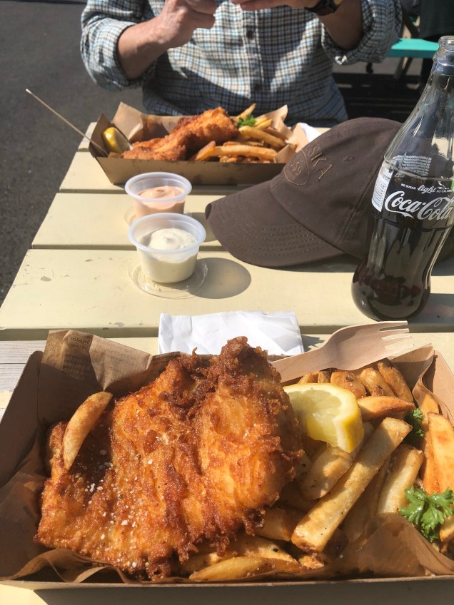
We were getting hungry so decided to find a place to eat. We stumbled upon a place called Finsens…I HIGHLY recommend this place! They only serve fish & fries. The fish is fresh and never frozen…it was delicious!
Even the locals were eating here! It’s near the water and they have picnic tables you can sit at.

After lunch, we headed to our next stop just 25 mins away called, the Berserkjahraun lava field..the road runs through the lava fields.
Views of the lava fields and more spectacular scenery along the way


Our next stop which was Kirkjufell mountain and Kirkjufellsfoss waterfall (same location).
This stop is 35 mins from Stykkisholmur.
You will see the Kirkjufell mountain first and can pull over at a few pull offs along the road to take pictures but the waterfall is just a few mins down the road.

On our way to the waterfall, we spotted this church. This area is called Grundarfjordur.
The parking for the mountain & waterfall was VERY busy and had limited parking.
We loved this stop! The views of the mountain & waterfall together were so beautiful!

Looking towards the parking area from the top of the waterfall


After leaving here, we headed to our next stop, Olafsvik. This stop was 20 mins from Kirkjufell.
Tip: Sheep are all over Iceland so be cautious because they will dart right in front of your car! Farmers allow them to roam free during the summer but in Sept rounds them all up for the winter. Read about the big annual sheep round up called the Rettir here.

More awesome views!

We passed this old lighthouse right on the side of the road

We passed the road that led to the Snaefellsjokull glacier but we skipped this stop. Read reviews here and book tours here & here.
We spotted this small waterfall on our drive to Olafsvik.
We stopped to take a few pictures of this old fishing boat sitting on the side of the road once we arrived in Olafsvik. The boat dates back to 1962.
As we were heading back to our car we found a small entrance through the rocks that led down to a black sand beach so we checked it out. We had the beach all to ourselves! So peaceful.


After our stop at the beach, we continued our drive to the first stop that I had on my itinerary for Olafsvik, another modern looking church called Olafsvikurkirkja.
This stop is 20 mins from Kirkjufellsfoss.


A shot of Olafsvik
We spotted the Maritime Museum in Hellissandur but it was closed so we just took a few pictures from the fence.


We then headed to our next stop, the Saxholl Crater. This stop is 20 mins from Olafsvikurkirkja.
Click here for more things to do in Olafsvik – book a whale watch tour here
We made a stop along the way at one of the golden sand beaches


We saw this sign at the location of the beach

We finally arrived to the crater.
Saxholl is a beautifully formed crater that erupted 3-4000 yrs ago. The crater rises 358 feet above sea level. The remnants of quarrying can be seen on one side of the crater.
There are over 300 metal steps you had to climb to get to the top! 

At the top you are walking across an old lava flow. You also have some pretty awesome views! There’s also a viewing dial that has the name of all the surrounding mountains.


We then headed to our next stop, Djupalonssandur beach & the Dritvik lava rock formations. It’s located about 15 mins from the crater.
Tip: You have the option of doing the Vatnshellir Cave tour located in this area. Click here to book tour.
We passed a lava field on the way.
We finally arrived to Djupalonssandur Beach..We loved this place! You could easily spend a couple of hours or longer here!

Don’t miss the hole in the rock!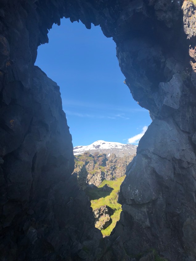


And the lifting stones…see how heavy a rock you can lift! Lifting stones are heavy natural stones which people are challenged to lift, proving their strength.
 This is all my hubby could lift! 😉

The walk was difficult as you are walking through very large rocks….another workout!
You will see remnants of an old ship wreck lying all over the beach. The English trawler Eding, wrecked at the Djúpalón beach in 1948.
These shipwreck remnants are meant to be a memorial to the 15 sailors who lost their lives. Five sailors did survive. None of these remnants are to be disturbed.

This small lake is also located here & is surrounded by unique lava formations 


So many cool looking lava rock formations …DO NOT MISS THIS STOP!


After leaving here, we headed to our next stop, the Malariff Lighthouse. It’s 10 mins from Djupalonssandur.
You can also see the Londrangar rocks from this same location but if you drive about 5 mins down the road there’s a car park for it that has better views.
Lóndrangar are uniquely formed basalt volcanic dikes sticking out from the ocean and are the remains of a crater, which has been eroded to its present form by the sea. Lóndrangar consists of two pillars or stacks, one of 246 ft and the other one of 200 ft.

Our next stop was Hellnar just 5 mins from Londrangar. The first thing we spotted when arriving to Hellnar was the Hellnar Church.
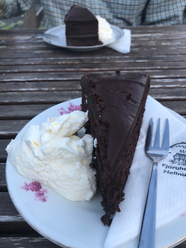
When visiting Hellnar, make sure to eat at the Fjoruhusid café that is nestled in the side of a mountain and next to the water!


 We enjoyed a delicious slice of chocolate cake! All of their cakes are homemade.
Right in front of the café, is a place where birds nest right down by the water. You will walk on some really big rocks to reach the area. We saw baby birds in nests up in the cliffs. You will also see the rock, Valasnös, with a huge opening.


Make sure you hike the 1.5 mi trail from Hellnar to Arnarstapi. We only walked it for about ½ mi and then turned around.


After leaving Hellnar, we then headed 5 mins down the road to Arnarstapi.
Once we arrived, we took a few pictures of the beautiful landscape.
The naturally formed harbor.

Arnarstapi has beautiful rock formations in the water
Make sure to capture that iconic shot of the house with the mountain behind it and the sea rocks in front of it! 🙂

We walked a little ways on the path that leads to Hellnar. We found the sea arch that you can walk across! Sadly, we missed the Gatklettur sea arch.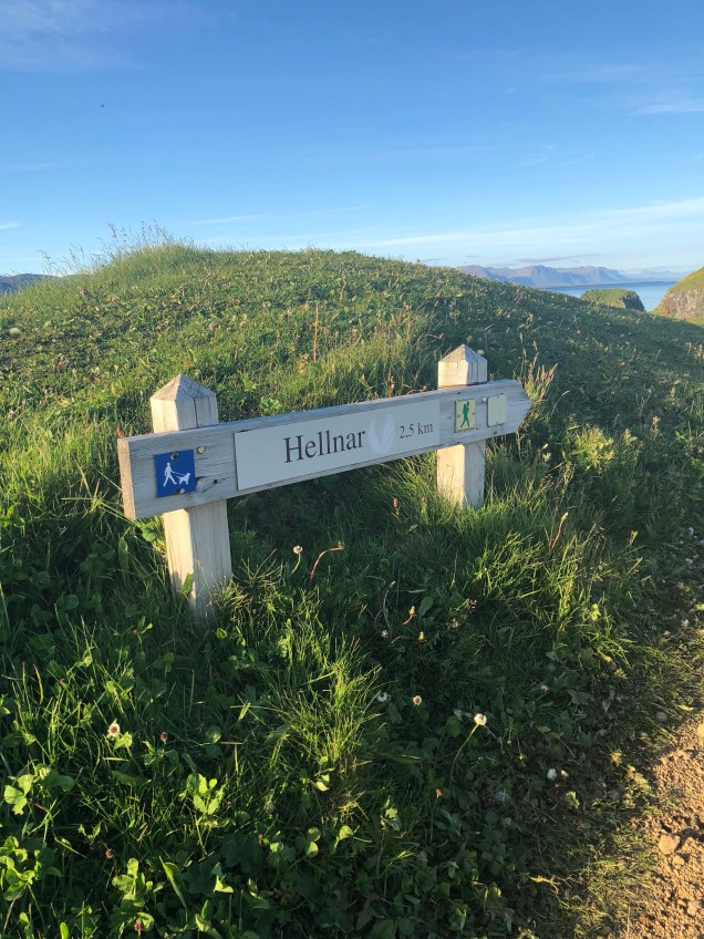
This is the sign you will see at the location of the arch you can walk across


We arrived in Arnarstapi as the sun was setting and were able to capture some beautiful shots of the sun setting behind the mountains

We then drove over to see the statue of Bardur Snaefellas
Bárður was the settler of this area, half a troll and half a man, his father was half a titan, but his mother was human. Bárður came to Iceland in the 9th century and gave the peninsula its name, Snjófellsnes peninsula, but both words “snær” and “snjór” mean snow in Icelandic.
Interesting…Trolls & elves & 1/2 humans oh my!! 😉

After leaving this area, we headed to our next stop, Raudfeldsgja Canyon. It’s only about 10 mins from Arnarstapi. You will see a sign for it on the main road. It was a bit of a steep & rocky hike to get to the canyon’s entrance.


Once we got to the entrance, we had to step on rocks through the shallow water. We then made our way inside the canyon and there was a huge chunk of ice at the canyon’s entrance.
We just took a few shots but didn’t continue our walk as it was very narrow and looked unsafe. I have read there’s a waterfall somewhere inside the canyon. 


After leaving here, we were heading to our hotel but spotted the Budir church (Budakirkja) from the road so decided to go ahead and stop.
We had actually planned on going the next day but since we were going to have to backtrack from our hotel we decided to go ahead and stop.
I’m so glad we did because the sky was beautiful and there were sheep near the church which made for a great shot!


After leaving the church, we headed to our guesthouse, the Kast Guesthouse. It was only 10 mins from the church.
View on the way to our guesthouse
We loved it here! The cost was around $185 and included a free breakfast.


The building we were in


A peek inside our room

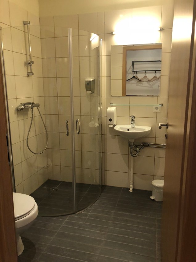
The registration & breakfast area 

View outside our window

Note: We had no TV in our room. A lot of the guesthouses don’t have them. However, we weren’t here to watch TV! 😉
Tip: Click here for more things to do in the Snaefellsnes Peninsula
This concludes day 5. Thanks for reading! Be on the lookout for day 6!
Here’s your route on the Google Maps App:


