Lighthouses

Hey guys!

I don’t know about you but I love photographing lighthouses. I think they are so beautiful and each one so unique. I also enjoy reading the interesting history behind them.

So, I thought I would do a post on some of the lighthouses that I have visited and photographed over the years. I’ll start with one that I’ve visited a couple of times, the Ponce de Leon Inlet Lighthouse.

I’m originally from FL and my Dad & Step mom still live there. They also own a condo on Daytona Beach so we have visited Daytona many times.

Ponce de Leon Lighthouse was completed in 1887 and is the tallest lighthouse in Fl and the 3rd tallest in the US stretching 175 feet into the sky. The tallest lighthouse in the US is Cape Hatteras Light in NC. It stands 207 ft tall.

Click here for a list of all lighthouses in the US & here  for the lighthouses that are listed on the National Historic list.

There was actually a lighthouse built here in 1835 but was attacked by Indians in the Second Seminole War. The war prevented repairs to the lighthouse and it later collapsed.

The original lamp burned kerosene but in 1909 was replaced with an incandescent oil vapor lamp. The lighthouse beacon was electrified in 1933 with a 500-watt lamp.

It became a National Historic Landmark in 1998…one out of only 11 lighthouses to earn this designation.

See a list of US National Historic Landmarks by state here.

You can climb the lighthouse’s 203 steps to the top for some spectacular views. There is also a museum at the lighthouse.

The Lighthouse and Museum is open to the public seven days a week with the exception of Thanksgiving and Christmas.

Admission  is $6.95 for adults and $1.95 for children (11 & under).
Infants (NB – 2) are admitted free of charge

Click here for more info on the lighthouse and read reviews here.IMG_8635

The next lighthouse is also in Fl…it’s the St. Augustine Lighthouse. The lighthouse was built in 1874 and stands 165 feet tall.

Construction began in 1871, and it continued for the next three years. Alabama brick and Philadelphia iron work combined with a new hand-blown, nine-foot-tall, Fresnel lens, from Paris, France was used in the construction.

This beacon was installed and lit in October of 1874 by head keeper William Russell and remains one of only a few such operating lenses in the United States.

A Spanish watchtower, built in the late 1500’s was the predecessor of the present St. Augustine Lighthouse.

The Lighthouse is St. Augustine’s oldest surviving brick structure, and today the site is restored to colors and materials used in 1888. In 1876, a brick light keeper’s house was added to the property.

Visitors can climb 219 steps up the historic lighthouse to see a breathtaking view of St. Augustine and the waters of the oldest continually occupied European port city in the continental United States.

At the top, the original, first order Fresnel lens still serves the beacon, but today is lit by a 1000 watt bulb. The St. Augustine lens consists of 370 hand-cut glass prisms arranged in a beehive shape towering twelve feet tall and six feet in diameter.

Admission is $12.95 for adults and $10.95 for children 12 & under. They also offer a ghost tour of the lighthouse for $24.95.

Read more history here and reviews here.IMG_8588

The next lighthouse is one of my favorites. I’ve visited it a couple of times. It’s the Portland Head Light in Portland, Maine.

The location of this lighthouse is what adds to its beauty. It sits along the rocky coastline of Ft. Williams Park. It’s one of the most photographed lighthouses in the US.

The construction of the lighthouse began in 1787 at the directive of George Washington, and was completed on January 10, 1791 using a fund of $1,500.

It was lit with 16 whale oil lamps.

It’s the oldest lighthouse in the state of Maine. The light station is automated, and the tower, beacon, and foghorn are maintained by the US Coast Guard. The former lighthouse keepers’ house is now a maritime museum.

The original plans had called for the tower to be 58 feet tall but when the masons completed the construction they climbed to the top of the tower and realized that it would not be visible beyond the headlands to the south, so it was raised approximately 20 feet.

The current keepers’ house was built in 1891. When Halfway Rock Light was built, Portland Head Light was considered less important and in 1883 the tower was shortened 20 feet and a weaker lens was added.

However, after mariners complained about the shortened lighthouse & weaker lens, the height and lens were restored back to it’s former height & lens in 1885.

The station has changed little except for the rebuilding of the whistle house in 1975 due to it being badly damaged in a storm. Today, the lighthouse stands 80 feet above ground and 101 feet above water.

The beacon is visible for 24 nautical miles. It has a 400 watt metal halide lamp that is rated for 20,000 hours and produces 36,000 lumens of light at 200,000 candlepower.

There is only one day each year when the Coast Guard allows a limited number of visitors inside the lighthouse: the annual Maine Open Lighthouse Day in September.

It was added to the National Register of Historic Places in 1973.

The Park is open year round from sunrise to sunset. Read reviews here.

enhance

enhanceenhanceenhance

The next lighthouse is outside of the US. It’s the California Lighthouse in Aruba. We visited this lighthouse when we visited Aruba for the first time in Nov 2017.

The lighthouse was constructed between 1914 & 1916 and stands 98 ft tall. It was named after the S.S. California, a wooden sailing ship that sank near shore in 1891.

The lighthouse keepers house has been turned into a restaurant called La Trattoria El Faro Blanco.

The lighthouse has completed a recent restoration in May 2016 which coincided with the 100th anniversary of the completion of the lighthouse.

There are several tours that you can do but for $10 you can climb to the top.

Due to it’s location, the lighthouse is a popular place to watch a sunset.

enhanceenhance

The next lighthouse is another favorite of mine. It’s the Pigeon Point Lighthouse along the Pacific Coast Hwy near San Francisco.

The lighthouse was completed in 1872 after many delays. It was named Pigeon Point because of a 175 ft clipper ship named, The Carrier Pigeon, struck rocks near the point of land where the lighthouse is now located.

At least 3 more ships were lost near the point in the 1860’s which prompted Congress to take action. In 1871, they appropriated $90,000 for a first class lighthouse & fog signal to be built.

The lighthouse is 115 ft tall and shares the title of the tallest lighthouse on the west coast with California’s Point Arena Lighthouse.

Marine mammals, such as seals and whales, can be seen regularly from shore as they pass by beyond the surf.

The lighthouse has restrooms as well as a small gift shop. There is also a hostel located at the lighthouse. Admission and parking is free. The lighthouse is open from 8 am to sunset.

Read reviews of the lighthouse here.

enhanceenhance

The next lighthouse is located in Capri, Italy. It’s called Punta Carena.

The lighthouse was built in 1866 and is 92 ft tall. It’s the second tallest in Italy (after Genoa). It is among the most important of all those guarding over the Tyrrhenian Sea.

At Punta Carena the seabed descends extremely quickly and, at only 500 meters from the coast, is already 600 meters deep.

You can reach Punta Carena Lighthouse Capri by foot or by bus. Walking could take up to an hour. The trek will start at the heart of Anacapri taking the Via Nuova del Faro.

We saw this lighthouse while we were doing a boat tour to Capri. It sits on the beautiful rocky coastline of the Tyrrhenian Sea off the Sorrentine Peninsula.

Read reviews here.

619d52fc1cf4c0cd1df8752a3d28465c

enhance

The next lighthouse is the Rockland Breakwater Lighthouse  located in Rockland, Maine about 1 hr 45 mins from Portland.

The lighthouse is located approximately 1 mile down a granite breakwater. In rough weather, the waves can sometimes lap over the granite blocks making them slippery. The granite blocks are also uneven and have spaces between them so it’s important to watch your step so you don’t fall.

The construction of the breakwater was approved in 1890 and was completed on November 24, 1899. Severe winter storms during the winter of 1899-1900 proved that the height needed to be increased.

A four-foot-high cap was completed on October 15, 1901, and included the base for a lighthouse to be built at the end. A total of 768,774 tons of stone were used for the project, total expenditure up to that point was $880,093.

In June 1900, Congress appropriated $30,000 for a lighthouse and fog signal at the outer end of the breakwater. At the lighthouse site, the breakwater is 65 feet deep, 43 feet wide at the top, and 175 feet wide at the bottom.

The lighthouse is built out of wood & brick and the tower is 25 ft tall. It was automated in 1965 and the keepers were removed.

Read reviews here.

enhanceenhanceenhanceenhance

Next we have another favorite. It’s called Gay Head Cliffs Lighthouse. It’s located in Martha’s Vineyard, MA. It was constructed in 1799 and is 170 ft tall.

In 1799 The Commonwealth of Massachusetts deeded 2 acres to the Federal Government to build a lighthouse that overlook the clay cliffs and Devil’s Bridge.

That same year, President John Adams approved the building of a 47-foot octagonal wooden lighthouse, a keeper’s house, a whale oil storage building, and various other outbuildings.

The 1799 installation of Gay Head lighthouse, along with a full-time lighthouse Superintendent and his family, represented the first “Whiteman” homestead established in Gay Head.

Read the history of Martha’s Vineyard here.

The supplier of the whale oil wrote a letter to congress that same year expressing his concerns about the possible negative impact that a Whiteman settlement could have in Gay Head and recommended someone else for lighthouse keeper.

In a section of his letter he stated the lighthouse keeper “may injure them by selling them liquor and, feeling much concern for that people, we hope it will meet thy views to have him put under positive restrictions thereupon.”

Later that same year, Congress chose to appoint Ebenezer Skiff as the island’s first Principal Keeper. Skiff became the first white man of European descent to live in the town of Gay Head. His salary was $200 a yr.

However, in 1805, President Thomas Jefferson increased Keeper Skiff’s annual salary from $200 to $250. He only received one other increase of $50 during his 29 yrs of service.  (1799–1828).

After his service, his son, Ellis Skiff took over and served as lighthouse keeper from 1828-1845.

In 1852, Congress approved $30,000 for the construction of a new brick tower and new keeper’s residence also made of brick. As a result, the existing 51 feet tall conical brick tower that stands today was started in 1854 and lit in 1856.

At that time in history, Gay Head was listed as the ninth most important lighthouse location in the United States.

The old wooden Gay Head Light was put up for auction in April 1857.

In August, 2009, Principal Keeper, Joan LeLacheur, gave President Barack Obama and his family a private tour during their vacation on Martha’s Vineyard.

This lighthouse also appears briefly in the background of the movie Jaws as Chief Brody is driving to the beach.

The Gay Head Light is managed by the Martha’s Vineyard Museum and is open to the public during the summer season, on special holidays, and for weddings and other private functions.

The lighthouse also offers tours and is opened 7 days a week from 10-4 and 6-8 on Thur & Fri for additional sunset hours. Admission is $6 and free for children under 12.

Read more history here and reviews here.

enhanceenhanceenhance

The next lighthouse is Edgartown Lighthouse and is also located in Martha’s Vineyard. It was first constructed in 1828 and later rebuilt in 1939. It stands 45 ft tall.

The first lighthouse, a two-story wooden structure that also served as the keeper’s house, was constructed in 1828. It was demolished, and replaced by the current cast-iron tower, in 1939. It is one of five lighthouses on the island of Martha’s Vineyard.

Originally located on an artificial island 1/4 miles from shore, the lighthouse is now surrounded by a beach formed, since 1939, by sand accumulating around the stone causeway connecting it to the mainland.

For the first two years of service, the offshore location required the Keeper to row a short distance. However, in 1830 Congress approved $2,500 for a wooden causeway to be constructed.

The wooden causeway was known as the “Bridge of Sighs.” A term that reflected the emotions of island people as they stood on the walkway watching whaling ships depart for voyages that lasted up to five years.

This first Edgartown Light was destroyed in the Hurricane of 1938. In 1939, the US Coast Guard demolished the existing buildings and installed an 1881 vintage cast-iron tower relocated from Ipswich Rear Range Light.

When reconstructed at the mouth of Edgartown Harbor, the relocated conical tower was fitted with the fourth-order Fresnel lens, electrified, and automated.

In 1987, the lighthouse was placed on the National Register of Historic Places. The following year, after completion of its restoration, the lighthouse was opened to the public for the first time in 55 yrs.

In 2011, the lighthouse was declared by the US Coast Guard to be no longer critical to its mission of safeguarding lives and property at sea so they listed for disposal as excess property.

The Town of Edgartown began the process of acquiring it under the National Historic Lighthouse Preservation Act, presenting its bid to the federal government in 2013.

The transfer process was completed a year later, and in January 2014, the town officially took possession of the lighthouse, paying the government the symbolic sum of one dollar.

Read reviews here and more history here. Click here for hours and admission prices.

enhance

Next we have the Telegraph Hill Lighthouse (AKA East Chop Light). This lighthouse is also located in Martha’s Vineyard.

The original lighthouse was erected in 1869. It was privately owned by a marine merchant named Captain Silas Daggett. It was destroyed by fire in 1871 and was rebuilt by the owner in 1872.

In 1875, Congress purchased the property from Daggett for $6,000 and removed the lighthouse and other buildings. In 1878 the present day cast-iron conical tower was constructed along with an adjacent two-story gabled roof keeper’s house. It stands 40 ft tall.

The lighthouse was originally painted white, but was repainted as a brown-red color in the 1880s. The brown-red color was maintained until 1988, when the light was painted white by Vineyard Environmental. The lighthouse was automated and unmanned in 1933.

In 1994, the Martha’s Vineyard Historical Society obtained a license for the US Coast Guard to open the lighthouse to the public. The lighthouse continues to aid navigation to this day.

In 1987 it was added to the National Register of Historic Places.

The lighthouse is located on Lighthouse Rd. in the town park of Oak Bluffs atop the highest protruding bluff on Martha’s Vineyard called East Chop. The Martha’s Vineyard Historical Society offers tours on Sundays from mid-June to mid-September for a small fee.

Read more history here and reviews here.

enhance

enhance

Next we have Nobska Point Lighthouse. It’s located at the entrance to Woods Hole Harbor, MA. We spotted this lighthouse when we were on the ferry from Woods Hole to Martha’s Vineyard.

In 1828, Congress had appropriated $3,000 for the lighthouse and had purchased 4 acres at a cost of $160 for the location of the lighthouse.

Nobska Point Light was built in 1828 for $2949.30. The original lighthouse was in the typical Cape Cod-style with an octagonal tower atop a stone keeper’s house, which had three rooms on the first floor and two small ones upstairs.

The lantern room held ten lamps with fourteen-inch reflectors, producing a fixed white light, seventy-eight feet above the sea.

A fog bell sounded by machinery was established at Nobska Point in 1875, and that year the Lighthouse Board noted that although “repairs of a temporary nature” had been made, the station was in a dilapidated condition and needed to be rebuilt.

The present lighthouse, a forty-foot-tall, cast-iron tower lined with brick, was erected in 1876 along with a one-and-a-half-story, wood-frame dwelling.

The tower was painted a dark reddish brown and had a rare adornment in the form of miniature lighthouses on top of each baluster that encircled the lantern room.

In March 2016,  the Town of Falmouth voted unanimously to approve a license with the Coast Guard that made the town the stewards of Nobska Point Lighthouse, and a formal transfer was held at the base of the lighthouse on April 25, 2016.

The town is now responsible for maintaining the four-acre lighthouse site and its historic keeper’s dwelling and lighthouse.

At a town meeting in April 2017, voters approved allocating $264,000 toward restoration of the lighthouse.

A ceremony to celebrate the start of phase one was held on September 15, 2017, and planning for phase 2 of the restoration, which will see the keeper’s dwelling become a maritime museum, is already underway.

Read more history here and here and read reviews here.

enhance

The next lighthouse is the Chicago Harbor Lighthouse located at the end of the Navy Pier in Chicago, IL.

On March 3, 1831, Congress appropriated $5,000 for a lighthouse to mark the mouth of the Chicago River. Before the lighthouse was completed, it collapsed on October 30, 1831.

“A few hours before it toppled over,” Andreas wrote, “so confident were many there was no danger of its falling, that several went upon the top of it, some of the visitors being women. The walls were three feet thick, and the tower had been raised to a height of fifty feet.”

The lighthouse was constructed in 1893 for the World’s Columbian Exposition and moved to its present site in 1919.  It’s 66 ft tall.

Surrounded by rip rap, the structure has several levels: a concrete base and two red roofed buildings with a tapered white cylinder between them which is topped by a parapet and the light itself.

In 1917 the breakwater was renovated. At that time, the lighthouse was moved to its present site, and its attached fog signal room and boathouse were built.

The light is an active aid to navigation, and no access is permitted.

A good view of the lighthouse may be had from Navy Pier, especially at the end of the Pier. Better views can be had by boat, including the various tour boats in the area.

The lighthouse was listed on the National Register of Historic Places on July 19, 1984, and later was designated a Chicago Landmark on April 9, 2003.

Read more history here and here.

IMG_5315IMG_5327

The next lighthouse is Ram Island Ledge Lighthouse. The lighthouse is located in Casco Bay, Maine marking the northern end of the main channel leading the harbor of Portland, Maine.

It was first constructed in 1905 and is 77 ft tall.

Ram Island, about a mile offshore from Portland Head near the entrance to Portland Harbor, is surrounded by dangerous ledges. In 1855 an iron spindle was erected to protect sailors from these dangerous underwater ledges. However, the ledge continued to be the site of repeated shipwrecks.

On February 24, 1900 the Allan Line steamship Californian ran aground on the ledge while en route from Portland to Glasgow, Scotland. As a result of that accident, the United States Congress appropriated funds to build a lighthouse.

Construction began on May 1, 1903 but due to the island being submerged much of the time, construction could only take place at low tide. It was completed in 1905. It’s a twin of the Graves Light off Boston.

The lighthouse was electrified in 1958, and then automated in 1959. The light was converted to solar power in January 2001.

The Ram Island Ledge Light was added to the National Register of Historic Places in March 1988.

In July 2010, the lighthouse was put up for sale to the general public. The minimum bid was $10,000.

The property had initially been made available at no charge to other government agencies, educational institutions, and non-profit organizations, but no interest was shown, so bids were opened to the general public.

The winning bid, $190,000, came from a Windham surgeon.

Read more history here.

4444cb3f17a9cbf39014815177859bdb

enhance

The next lighthouse is Egg Rock Lighthouse located in Bar Harbor and can only be seen by boat.

Egg Rock Lighthouse was built on 12.5 acre Egg Rock in 1875, is still active today and is owned and managed by the U.S. Fish and Wildlife Service. The tower is 40 ft tall.

The 1.5 story wood keeper’s house, also built in 1875, is actually an integrel part of the tower. The fog signal house, oil house, boathouse, and generator house were built later in 1904.

It is one of coastal Maine’s architecturally unique lighthouses, with a square tower projecting through the square keeper’s house.

Located on Egg Rock, midway between Mount Desert Island and the Schoodic Peninsula, it is an active aid to navigation, flashing red every 40 seconds.

The light was listed on the National Register of Historic Places as Egg Rock Light Station in 1988.

The station was automated by the United States Coast Guard in 1976, at which time its ancillary structures except the fog station were torn down.

The lantern house was removed and the light was replaced by the present aerobeacon. After public protest, a replacement lantern house was installed in 1986. The light is not open to the public.

Read more history here and here and read reviews here.

If you look closely you can see seals on the rocks.

966d12710e0dd83a74242c26e2aceab4

The next lighthouse can be found at Acadia National Park. It’s called Bass Harbor Head Light. 

This lighthouse was built of brick in 1858 on a stone foundation, stands 56 feet above the water and is accessible by car off Route 102A. Parking is free and is open daily from 9:00 AM to sunset.

In 1885, the U.S. Congress appropriated $5,000 for construction of the lighthouse. In 1876, construction was completed on a fog bell and tower, since removed. A much larger 4,000-pound bell was placed inside the tower in 1898. The tower is 32 ft tall.

The house of the lightkeeper remains in its original configuration with the exception of a 10-foot addition that was added in 1900.

The lighthouse was added to the National Register of Historic Places as Bass Harbor Head Light Station on January 21, 1988.

In July 2010, President Barack Obama became the first sitting president to visit Acadia National Park. He & his family spent three days in the park and paid a visit to Bass Harbor Head Lighthouse.

In November 2017  the Park Service took possesion of the property. To generate revenue for the upkeep of the property that have considered turning the 2 bedroom lighthouse  into a vacation rental or opening a café or coffee shop in it.

There is a short walk which takes one to a series of wooden steps that lead down onto the many granite boulders that provide a great view of the harbor side of the lighthouse.

Read more history here and here and read reviews here.

I’ve been here to watch the sunset and it was gorgeous! Add this to your “must see” list when visiting Acadia National park.

enhanceenhanceenhance

enhanceenhanceenhance

Our next lighthouse is the very small Portland Breakwater Lighthouse located in Portland, Maine.

The lighthouse was first built in 1855, as a wooden structure, but the breakwater was later extended and a new lighthouse was constructed at the end of it in 1875.

The Lighthouse Board asked Congress in 1853 for an appropriation of $3,500 for a lighthouse and keeper’s house, or for $1,000 if it was deemed that no keeper’s house was needed. An appropriation of $3,500 was made on August 3, 1854.

Construction took about four months during the following year, and on August 1, 1855, a small, octagonal wooden tower went into service.

After a congressional appropriation of $6,000 in June 1874, a new lighthouse was erected on a granite foundation at the end of the structure. The original tower was moved to Little Diamond Island, where it became a lookout tower at a buoy depot.

The new lighthouse was made of curved cast-iron plates whose seams are disguised by six decorative Corinthian columns. The cylinder, a little less than 12 feet in diameter, is surrounded by six fluted columns.

During WW II, the breakwater was slowly absorbed by landfill as the New England Shipbuilding Corporation built two shipyards next to the lighthouse. These shipyards produced Liberty Ships for the war effort.

Because of the smaller breakwater, there was a lesser need for the lighthouse and it was decommissioned in 1943.

The light was fully restored in 1989 and was reactivated in 2002. Today a park named after the lighthouse, Bug Light Park, allows visitors to view the Portland Breakwater Light up close, while memorializing the shipbuilding efforts of World War II.

The light was added to the National Register of Historic Places as Portland Breakwater Light on June 19, 1973.

Read more history here and here and read reviews here.

enhance

Next is a lighthouse called Spring Point Ledge Light.

This lighthouse was constructed in 1897 by the government after seven steamship companies stated that many of their vessels ran aground on Spring Point Ledge. The tower is 54 ft high.

Congress initially allocated $20,000 to its construction, although the total cost of the tower ended up being $45,000 due to problems with storms and poor quality cement.

The lighthouse featured a fog bell that sounded twice every 12 seconds, and a lantern fitted with a fifth order Fresnel lens first lit by Keeper William A. Lane on May 24, 1897.

It was electrified in 1934, and in 1951, a 900-foot breakwater made from 50,000 short tons of granite was constructed in order to connect the lighthouse to the mainland. The lighthouse was originally owned and operated by the United States Coast Guard.

However, on April 28, 1998, the Maine Lights Selection Committee approved a transfer of ownership of the tower to the Spring Point Ledge Light Trust, with the USCG retaining only the light and fog signal.

On May 22, 1999, Spring Point Ledge Light was opened to the public for the first time in its history. It is a popular spot on any summer day for families to picnic and boat-watch on the breakwater or for fisherman to spend an afternoon catching fish.

Adjacent to the lighthouse, visitors may also tour the old Fort Preble, the Southern Maine Community College Campus, and visit a small gift shop.

It was added to the National Register of Historic Places as Spring Point Ledge Light Station on January 21, 1988.

Read more history here and here and reviews here.

enhance

The next lighthouse is located in Italy near Murano called Faro di Murano...which simply means the Lighthouse of Murano.

The Murano Faro was built in 1912. It has a focal plane of 121 ft. It’s a round cylindrical stone tower with lantern and double gallery. The lighthouse is painted white; near the top there are three black horizontal bars facing the range line.

The lantern appears to be empty and without glass; the light is apparently mounted on the top gallery rail. The lighthouse has a distinct lean in the seaward direction.

Murano is part of the city of Venice but about 1 mi to the north; it is accessible by waterbus from the central city. Located 2 mi west northwest of the front light, on the southeast side of the Isola di Murano, near the foot of the Calle Giuseppe Briati.

The lighthouse marks the entrance of the channel which leads from the sea to the lagoon. The location of the lighthouse is open but the tower itself is closed.

I couldn’t find a lot of information online about this particular lighthouse. Read reviews here.

enhance

The next lighthouse is Sandy Neck Lighthouse in Barnstable near Cape Cod, MA.

It was first established in 1826. The current tower was built in 1857 and strengthened in the 1880s. It was discontinued in 1931, replaced by a skeleton tower, which was discontinued in 1952. The light was relit as a private aid to navigation in 2007.

After Sandy Neck Lighthouse stood “headless” for nearly seventy-five years in spoiled beauty, volunteers were finally spurred to restore the lighthouse to its former glory.

On May 18, 1826, Congress approved $3,500 for a lighthouse on Sandy Neck’s eastern extremity, known as Beach Point. In a show of support, the town of Barnstable sold a two-acre parcel for the light for only one dollar.

On October 1, 1826, Sandy Neck Lighthouse, which cost in total $2,911.25, went into service. Joseph Nickerson, its first keeper, earned $350 per year and remained at the light for seven years.

On October 20, 2007, the sesquicentennial year for the 1857 tower, a group of supporters aboard a Hyannis Whale Watch vessel, looked on as a cover was removed from the lantern room allowing Sandy Point’s beacon to beam forth once again.

The station’s oil house, built in 1905, was restored in 2008, and in 2010 a light-emitting-diode beacon was installed in the lantern room, increasing the range of the light from 4.2 to 10.4 nautical miles.

Looking now at the charm of this lighthouse flanked by its six-room keeper’s house and situated on the low, eastern point of Sandy Neck at the entrance to Barnstable Harbor, it is easy to forget the sacrifices of the men and two women who tended this light during its century of service.

We also spotted this lighthouse on a Hyannis Whale watch vessel.

Read more history here .

enhance

enhance

The next and also the last lighthouse is a lighthouse and a fog station that sits under the Golden Gate Bridge in San Francisco and can only be seen by boat. It’s called the Lime Point Light.

The brick structure for the Lime Point Lighthouse was built in 1883 as a fog-bell signaling station. It was eventually fitted with coal powered 12-inch steam whistles.

During operation, the facility included the fog signal building, a coal shed, water tank, and a two-story keeper’s quarters. The keepers building later upgraded to include a third floor.

In 1900, a lens lantern was hung on the south-east corner of the fog signal building, at a height of 20 feet above the water. In 1902, the coal-powered steam horn was modified to use crude oil to reduce operating costs and smoke pollution.

The lighthouse continued to operate after the completion of the Golden Gate Bridge since it remained an effective position for a light and fog horn.

The lighthouse was automated by the United States Coast Guard in 1961, and the three-story dwelling and other buildings were torn down, leaving only the fog signal building.

According to John Martini, a historian for the National Park Service, the building is what’s left of the original Fog Station located on the site. The building served as a fog signal station and eventually a lighthouse at that location.

enhanceenhance

The US has had approximately a thousand lights as well as light towers, range lights, and pier head lights. Michigan has the most lights of any state with over 150 past and present lights.

Most of the lights in the US have been built and maintained by the Coast Guard (since 1939).

As their importance to navigation has declined and as public interest in them has increased, the Coast Guard has been handing over ownership and in some cases responsibility for running them to other parties, the chief of them being the National Park Service under the National Historic Lighthouse Preservation Act of 2000.

Fun Facts:

The Oldest Lighthouse in the US is : Boston Harbor Light built in 1783 (1st built in 1716). It’s the 2nd oldest working light in the US after Sandy Hook Lighthouse in NJ that was built in 1764.

The Tallest Lighthouse in the US is: Cape Hatteras in NC – 193 ft tall

The Smallest Lighthouse in the US is: Lime Rock in Newport, RI (13 ft) – it also has some of the most fascinating history about the keepers.

The Tallest Lighthouse in the World Jeddah Light in Saudi Arabia stands 436 feet tall

Most Expensive Lighthouse in the US is: St. George Reef, off Crescent City, CA. It took ten years to construct (1882 – 1892) and cost $715,000.00.

Thanks for reading!

PLEASE NOTE: ALL INFORMATION IN THIS BLOG POST WAS COMPILED BY MULTIPLE SOURCES FROM INTERNET WEBSITES. ALL SOURCES HAVE BEEN LINKED IN THIS BLOG POST. THESE WRITINGS ARE NOT MY OWN AND I DO NOT TAKE CREDIT FOR ANY INFORMATION POSTED WITHIN THIS BLOG POST. ALL CREDIT IS GIVEN TO THEIR RIGHTFUL OWNERS BY CLICKING ON THE LINKS WITHIN THIS POST. HOWEVER, ALL PICTURES IN THIS POST BELONG TO ME.

3 Days in LA & Malibu

Hey Guys!

This is my final blog post on our time in the LA area. We flew in on a Mon and flew back home on Sat. We spent our first day in Palm Springs, the next day we spent at Joshua Tree National Park and our final 3 days were spent around LA and Malibu.

After leaving JTNP, we arrived at our Airbnb property in West Hollywood. We had booked with this same host last year and although we had a few minor hiccups, we knew she was always quick to respond to our needs. So, I decided to book with her again.

The property we rented last year was already booked but this host has several properties and she had another apartment available in the same building. We liked the location of these apartments as everything we wanted to see and do were very close. Here’s the property we rented.

It had 2 bedrooms, 2 bathrooms, kitchen w/ a table and 4 chairs and a living room. It was an older property but clean. There was free parking under the building in a parking garage. We also had free Wifi.

I usually always take pics of the places we stay so I can use them for my blogs but I failed to do that on this trip. This was the only pic I took inside the apt.Image-1As you can see, it was very spacious…. and when we travel with our daughter, it’s nice that we all have our own bedroom and bathroom. Makes life a lot easier when you have a daughter who takes forever in the bathroom!
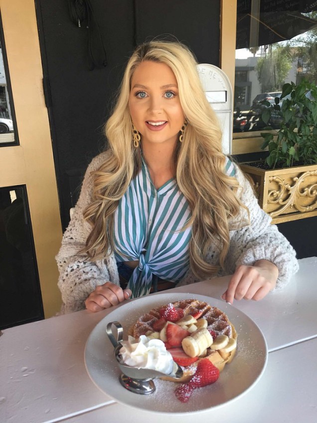
The next morning we headed to a restaurant that we had eaten at last year, Toast. We all really liked the food and atmosphere. They have indoor and outdoor seating…we, once again, opted for outside seating.

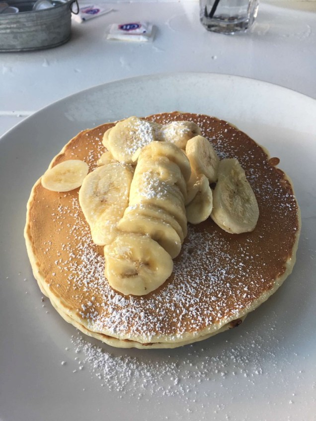
My daughter ordered the waffles with strawberries, my hubby ordered the pancakes and I ordered the yogurt with granola…everything was delicious!Image-1Image-1

Thankfully, they had heat lamps as it was a bit chilly that morning. The food and service is really good here and I recommend you give it a try if you are ever in the area….But, a word of warning, we tried to go back Sat before we flew home and it was packed out so we didn’t stop.

We had a full day planned so after breakfast we headed to our first stop of the day, Venice Beach. We came here last year and rented bikes and wanted to do it again. I was a bit apprehensive about doing it last year since I hadn’t ridden a bike in years, but it was really easy and so much fun!

I can’t recommend it enough…we rented from Venice Beach Rentals and paid $105 to rent 3 bikes all day. However, as we were riding our bikes, we noticed other bike rental places that were much cheaper. Click here for a list of other bike rental companies.Image-1Image-1

We rode our bikes down to the Santa Monica pier which is about 2 miles. It was a very easy ride as the bike path is paved and flat the whole way. The bike rental place gives you a chain and lock so you can chain up your bike if you want to stop off anywhere.

We wanted to ride the ferris wheel. The ferris wheel is the world’s only solar powered ferris wheel. It gives you a panoramic view of the coastline of more than 130 feet above the pier. If you are here at night, the ferris wheel lights up using more than 174,000 LED lights.Image-1Image-1Image-1Image-1The cost to ride is $10 pp. If you want to ride several rides, you can purchase an unlimited ride wristband for $32.95 for ages 8 and up ($29.65 if purchased online) and $17.95 for ages 7 and younger ($16.15 if purchased online).

We only rode the ferris wheel and then walked around the amusement park and boardwalk for a while.Image-1Santa Monica Pier symbolically marks the end of Route 66. A sign, on the bridge that extends out into the Pacific Ocean, indicates the precise point.

Image-1There are a total of 12 rides in the park…they also have games and a variety of food to choose from. The pier has been featured in over 500 movies and TV shows….read about the history of the pier here.

After leaving the boardwalk, we walked up the steep sidewalk to the street to take a picture of the Santa Monica Yacht Harbor sign. It was installed in 1940. It also lights up at night. Click here to read more interesting facts about the pier. Image-1We then headed back to Venice beach to turn in our bikes so we could just walk around the area. Venice beach has some very shady characters…there are A LOT of homeless people here and they just camp out right on the beach.Image-1

Don’t miss seeing the iconic muscle beach. It’s been around since 1934.

Image-1

Also, not to be missed, is the Venice sign on Windward Ave. The sign is a replica of the original one that was installed in 1905 by the legendary Abbot Kinney. The new one was installed in 2007 and lights up at night.Image-1Image-1Another not to be missed sight is the Venice Canals. The canals were built in 1905 by developer Abbot Kinney as part of his Venice of America plan. Image-1Image-1Image-1

We then walked to Abbot Kinney Blvd. My daughter had wanted to go here last year but we didn’t get a chance to make it there. I have to say, I wasn’t impressed. Maybe it’s an age thing, I don’t know. 🙂 It’s a mile long strip of the latest fashion, art and food.

The only place we stopped was Salt and Straw. An ice cream shop known for its inventive flavors and farm sourced ingredients. The ice cream was really good.

We then headed back to Venice beach and made one last stop, the boardwalk. Lots of people fish off the pier and birds are always hanging out here because of that.Image-1Image-1Image-1

If you’re not careful, they may even attack you! 😉

Image-1

After leaving this area, we headed to another restaurant that we ate at last year, Lemonade. This place is so good! Make sure to order a lemonade while you are here…the best I’ve ever had!

My daughter and I ordered the herb grilled chicken sandwich meal…it comes with chips and a tomato and avocado “salad” and it was delicious! It’s so much food you can’t eat it all. My hubby ordered the grilled cheese sandwich and he really enjoyed his as well.Image-1Image-1

After lunch, we headed to our next stop, LACMA. We were only interested in seeing the outdoor light installation called the Urban Lights. The Urban Lights are 202 restored cast iron antique street lamps.

Last year when we visited, this was our first stop after leaving the airport and there was no one here when we arrived. This time, it was crowded…..however, we did get to see the lights turn on. The lights are solar powered and come on at dusk and go off at dawn.

There is street parking on Wilshire Blvd. and surrounding streets but parking directly in front of LACMA’s plaza area is restricted. There are two LACMA parking lots (6th St. east of Fairfax, and at the corner of Wilshire Blvd. and Spaulding); $12, free after 7 p.m.Image-1Image-1Directly across the street from the Urban Lights is another art installation…part of the Berlin Wall.

The original Berlin Wall segments were transported to Los Angeles and installed in mid-October 2009. It’s the largest stretch of the original Berlin Wall in the world outside of Berlin. Read more about it here.Image-1Image-1

We then headed back to our car and noticed that we had parked near the La Brea Tar Pits. The museum was closed but the grounds where you could view the tar pits were still opened. So, we walked over to take a look.

The tar pits is where natural asphalt has seeped up from the ground for thousands of years. Over many centuries, the tar has preserved the bones of trapped animals. The museum displays specimens from the animals that have died there.

Read reviews here.

Image-1Image-1Image-1

After leaving the tar pits, we called it a day and headed back to our apartment.

The next day, we headed to Alfred’s Coffee to get our caffeine fix. Their coffee is really good.Image-1Image-1Next we stopped at a few wall murals so my daughter could get some shots for her blog/Instagram. The hubby and I got a few shots too. 😉

The first wall was on the side of Carrera Cafe, which is known for their screen printed coffees. Image-1The next wall was the Made in LA wall which is located at 8025 Melrose AveImage-1And next and very close to the last wall is, Paul Smith’s Pink Wall ..it’s located at 8221 Melrose Ave.

Last year they had strict rules about taking pics here and even had a security guard stationed at the wall to make sure you followed the rules…this time, the rules and security guard were gone. Image-1For more walls around this area click here and here

We then headed for the Hollywood Walk of Fame.The Hollywood Walk of Fame comprises more than 2,600 five-pointed terrazzo and brass stars embedded in the sidewalks along 15 blocks of Hollywood Boulevard and three blocks of Vine Street.

This area has a lot of sketchy people hanging around and it’s not very clean. However, it was cool to see.

If you visit the area, make sure you check for upcoming star ceremonies. These are open to the public and you may get to see your favorite celebrity. The ceremonies start at 11:30 am.Image-1Image-1Don’t miss seeing the Grauman’s Chinese Theater. It opened in 1927. Image-1Look for the footprints, handprints and other prints on the concrete in front of the theater. Click here for more imprint ceremonies.Image-1Image-1

After leaving the theater, we looked for somewhere to eat. We came across the Hollywood and Highland Center. It has 4 different levels and has a variety of restaurants and shops. We decided on California Kitchen.

We’ve eaten at this restaurant before in our home state and really like their food ….it didn’t disappoint this time either. The food and service was very good.

Image-1Image-1You had a view of the Hollywood sign from the shopping center.Image-1After lunch, we walked around for a little while longer. We had our picture taken in front of a souvenir shop….the only catch, we had to go in the store and look around. Yep, we left with souvenirs…everything was really cheap.Image-1

After leaving this area, we headed to get a better view of the Hollywood sign. The first sign, erected in 1923, actually said Hollywoodland. The sign was in disrepair in the 60’s and in late 70’s was rebuilt…this time, it said Hollywood.

The best way to get to the sign is to put in the address of the Lake Hollywood Park at 3160  Canyon Lake Dr or you will go through a residential area with extremely narrow roads.

Once you are at the park, keep driving past it towards the top of the hill. You will see parking on both sides of the road.

The pic below is of the Hollywood Reservoir behind the Mulholland Dam. It’s located across the street from the side of the road the sign is located.

There are hikes that you can do to the sign…however, you can’t get too close to it as there is a police officer stationed at the sign and 24 hr camera survelliance.

Image-1Image-1

Yes, I actually touched the sign! 😉

Image-1

After leaving here, we headed to the Griffith Observatory. Admission to the observatory, grounds and telescope is free. However, parking is $4 an hr. There are hiking trails as well as a cafe and a gift shop.

Lots of people will come here to watch the sunset. You also get a view of the Hollywood sign and downtown LA from the observatory.

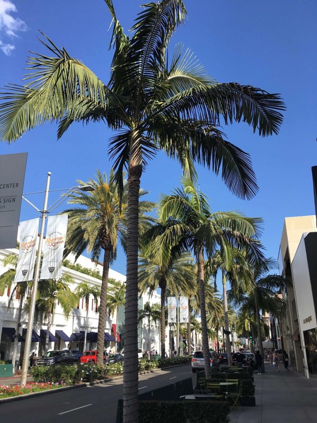
I recommend you pay to park otherwise you will have to walk up a very long, steep hill.Image-1Image-1Image-1After spending about an hour here, we headed to our next stop, Rodeo Drive. This is just one of those “must dos” when visiting LA. Rodeo Drive is a 2 mile long street lined with over 100 luxury boutiques.

Read about the history of Rodeo Drive here.

When visiting Rodeo Drive, don’t miss seeing Beverly Hills Park. Unfortunately, It was closed for renovations during our visit.

Also worth a visit is the Beverly Wilshire hotel, a landmark since opening in 1928. Many celebrities have lived here. It also served as the backdrop for several scenes in the movie, Pretty Woman.

Other must sees are the Rodeo Drive Walk of Style, the Anderson Court Shops, the House of Bijan and Two Rodeo Dr.Image-1Image-1Image-1

Our next and final stop for the day was The Grove Shopping Center. This place has a bit more affordable shopping than Rodeo Dr. 😉 We came here last year too and really enjoyed it. It’s a neat place to hang out for a few hours.Image-1Image-1

Not only do they have shops and restaurants but it’s also the location of the world famous Farmers Market. It first opened in 1934 and today has more than 100 vendors, including ready-to-eat foods, grocers, and tourist shops.

It’s opened 7 days a week.

Once again, my daughter and I had to buy some macarons from the one and only, Laduree. Image-1

Another place to check out is See’s Candies.…some of the best chocolate I’ve ever eaten! They offer over 100 different kinds of candies and chocolates and let you sample it before you buy…believe me, once you try, you will buy!

They have been around since 1921.

We then decided it was time to eat. Last year my daughter had wanted to try Umami Burger but we opted for the Cheesecake Factory instead…both of these restaurants are at the Grove.

So, this time we decided to give it a try. I was a bit apprehensive after looking at the menu as their burgers sounded a bit odd…I mean what is falafel and bacon lardons?

Well, let me just say, their burgers were out of this world! We all agreed…my hubby even wanted to come back the next night! I can’t recommend this place enough…if you like burgers, you have to try this place!! The service was great too!

I ordered the slider trio (seen below) and one of the burgers I ordered was called the impossible. It’s a plant based “meat” patty between two vegan buns and I could hardly tell the difference….so good!

Image-1Image-1Image-1

After dinner, we called it a night.

The next day we planned on spending the day driving along the Pacific Coast Hwy and checking out the beaches along the way.

We started the next morning off with some delicious donuts from California Donuts. This place is very popular and stays really busy. It’s open 24/7 and there is very limited parking.Image-1Image-1Image-1

We then headed to the Pacific Coast Hwy. The drive from West Hollywood to Malibu takes about an hour. We wanted to drive to Point Mugu and then on the way back, stop at some of the more popular beaches.Image-1I have to say, this was definitely one of my most favorite things we did while visiting the LA area. We’ve driven part of the PCH in San Francisco and the scenery is just breathtaking!Image-1

From 1937-40 workers blasted a roadway through Point Mugu. Prior to that, a route had been blasted out around the promontory in 1923-24 to complete the Pacific Coast Hwy between Malibu and the Oxnard Plain. This narrow path was dangerous and much of it has since eroded away. Read more about it here.

Mugu Rock appears frequently in car commercials. There’s actually a commercial currently showing on TV that features Matthew McConaughey driving a Lincoln near Mugu Rock.

Image-1

The remains of the old road ..it earned the name Dead Man’s Rock after several drivers plunged their cars into the Pacific ocean below.Image-1

In the shot below you can see where the road used to go around Mugu RockImage-1

While driving the PCH, we stopped off at one of the most popular beaches on the highway, El Matador State Beach. Don’t miss this beach, it’s beautiful!

Lots of great rock formations and tide pools. There are quite a few stairs and a steep, sandy path to walk down but it’s worth the effort. It’s usually pretty busy at this beach. You do have to pay to park.Image-1Image-1Image-1

Our next stop was finding somewhere to eat…we decided on Neptune’s Net. We had read about how popular this place was but I have to say, I wasn’t impressed.

It’s directly across the street from a surfing beach.

The restaurant opened in 1956 under a different name. It wasn’t until 1974, when it was sold, that the name was changed to Neptune’s Net. The restaurant has been featured in many movies and TV shows.

I ordered the fish tacos and the hubby ordered shrimp and fish. My tacos were very bland…hardly any taste.

You walk in, claim a table and then go to the counter and order your food. When it’s ready they will bring it out to you.Image-1Image-1Image-1Image-1

After lunch, we stopped at a couple of other beaches.

The beaches I would recommend you stop at are: Zumba Beach, Leo Carrillo State Park, Westward beach, Point Dume State beach, Robert H Meyer Memorial State Beach and El Matador.

For food along the PCH, I suggest: Malibu Farm Restaurant/Cafe on the Malibu Pier,  Lily’s Cafe, Paradise Cove Beach Cafe ($6 parking when you spend $30 at cafe, otherwise it’s $40 to park).

After spending most of the day driving the PCH and stopping off at several of the beaches along the way, we headed back to the West Hollywood area.

Once again, we headed to a restaurant that my hubby had read about called Carney’s. It’s a simple counter-serve cafe in a vintage railcar, selling hot dogs & burgers with a range of toppings.

It’s a very popular place…but again, I wasn’t very impressed. I was trying to eat somewhat healthy on this trip ..so, I chose the Thai Chicken wrap. It wasn’t bad just a bit bland. Maybe I should have just stuck with what they are known for, their burgers and hotdogs. Image-1Image-1Image-1Image-1

After eating, we walked outside and took a few pics of the restaurant…as we were taking pictures, a couple walked by on the sidewalk. I never even noticed them but my hubby said he thought it was Matthew McConaughey.

I just ignored him, as usual, because I thought he was joking..until a tour bus filled with tourists pulled up to the sidewalk beside him and started screaming! My daughter took off behind them …Image-1

After a couple of minutes, she came back and we left. A few blocks up, we spotted them again walking down the sidewalk.

We pulled over and my daughter jumps out and ask if she could get a pic with him…he politely declined and kept walking…she was very disappointed.Image-1Image-1

After “stalking” Matthew, we drove the sunset strip Image-1

We then headed in for the night…we were flying out the next day.

The next morning, after checking out of our Airbnb, we tried finding somewhere to eat but everywhere we went was packed out. So, we headed to a place near the airport called, Randy’s Donuts. 

Randy’s was built in 1953 and is a landmark building in Ingelwood. You can’t miss it with its giant doughnut on the roof. The shop’s exterior has been featured in numerous TV shows and movies.

This place was super crowded when we arrived and has very limited parking. You can either walk up and order or use the drive thru on either side of the building.Image-1Image-1

I ordered the Texas glaze and had no idea what I was in for! This donut was as big as my head! So much for eating healthy! 😉

We also ordered the chocolate iced, blueberry iced cake and a vanilla iced cake…all were very fresh and so good!

Image-1Image-1Image-1

After leaving here, we headed to the airport. However, on the way, my daughter spotted a wall that she wanted to stop and snap a few pics. It’s the California Dreaming wall..it’s located at 3485 La Cienega Blvd, Los Angeles.

Yes, that’s me…I had to have my picture taken here too. 😉

Image-1We spotted the Goodyear blimp on the way to the airport. Goodyear has 3 blimps still in operation but has operated as many as eight at a time since its first commercial airship, the Pilgrim, flew in 1925.Image-1

After a 4 hr flight delay due to “mechanical problems” we were finally on our way home!Image-1Goodbye LA, it was fun!!

Thanks for reading!

I hope this helps you plan your own trip to the LA area. If you have any recommendations or suggestions, please feel free to leave a comment.

LA, Palm Springs & Joshua Tree Ntl Park

We visited LA, Palm Springs & JTNP for 4 nights in April 2017.

My daughter is a fashion blogger and had been begging me to go to LA with her.. I honestly had no desire to go but, I have to say, after going I really enjoyed it and would love to visit again one day.

We arrived in LA at 9:40 on a Tues morning. We rented a car from Alamo for less than $250.
enhanceAbout to land at LAX Airport

enhanceLook at all that traffic down there!

Tip – After making reservations online, you should keep checking prices on a regular basis to see if the price drops. I think we rebooked the car 3 different times due to the price dropping.

Also, when you rent from Alamo, they offer a “skip the line” service..this allows you to go straight to your rental car without going to the customer service desk to check in. To do this, you have to choose this option during or after you book your car online.

You then will have to enter your driver’s license info and payment information. I had used this service for the first time when we went to Hawaii and loved it!

Since we were only going to be in LA for 3 full days, I had us on a very busy itinerary. We left the airport and headed straight to the first stop which was the Urban Light Art Installation outside of the LACMA.

We only wanted to see the outside light installation and snap a few pics. The Urban Lights are 202 restored street lamps from the 1920’s and 30’s.

There is parking at the corner of Wilshire Blvd & Spaulding for around $15. enhanceWe also saw another art display in this same area that we weren’t expecting to see…part of the Berlin Wall. Read about this “art installation” here.

enhanceenhanceenhance
We were ready for lunch so we headed to one of the places you just have to go when in LA, In-N-Out Burger. They opened their first location in 1948..they now have over 300 locations. Their burgers are so good!enhanceAfter we ate, my daughter had several places that she wanted to go. With her being a fashion blogger, she had researched all the “trendy” places to go so she could shoot some pics for her blog.

So, we headed to Dinosaur Coffee. It’s located on Sunset Blvd. They are open daily from 7-7. My daughter ordered a coffee and loved it!enhanceenhance
1st pic above is a wall hanging inside the coffee shop

We then walked to the nearby Bates Motel. This is an old hotel that closed in the late 90’s. It was once the Sunset Pacific Motel but the locals refer to it as the Bates Motel because it sits on the corner of Sunset Blvd & Bates Ave.

A Paris based artist collaborated with the city of LA to turn it into an art installation by painting it all white. See what it looked like here.

I wasn’t impressed as it looked nothing like the pictures we saw online. It’s not opened to the public and was surrounded by a fence…looked more like a prison to me.

enhanceWe then headed to the Hollywood Walk of Fame. We wanted to see those iconic stars on Hollywood Blvd. The first stars were unveiled in 1958.

You can click on the link I added above and check the schedule for unveilings. They have several throughout the year and they are free.

It was very cool to see this area but it was so “seedy”. There were so many sketchy people hanging around and several would approach you trying to sell you something or try to get you to take a picture with them. I held onto my purse very tight!

We also saw them setting up for a movie premier in front of the Grauman’s Chinese Theater. You can click here to find out about upcoming movie premiers and a chance to see your favorite actor.enhanceenhance

enhanceI was ready to get out of this area pretty quickly! We then headed  back to our car to head to our next stop, the Hollywood Sign. It was about a 20 min drive from Hollywood Blvd. on Canyon Lake Dr.

There is a hike you can do where it takes you behind the sign but we didn’t do it.enhanceWe then headed to the Griffith Observatory. You can go here and see awesome views of LA and the Hollywood sign. We only visited the grounds and walked around the observatory…we never went inside. It’s a very cool looking building.

This place was extremely crowded and I recommend you get here early. There is parking in front of the observatory but you have to pay.

However, it’s very reasonable and worth the money. If you have to park in the parking area below the observatory, you have to walk uphill.

It was about a 30 min drive to get to the observatory from the Hollywood sign. The drive took you through a residential area lined with huge trees..they were beautiful!enhanceenhanceenhanceenhanceView of the Hollywood sign from the Griffith Observatory

After leaving here, we were ready to go eat dinner. We headed for the Grove Shopping Center. We had planned on trying out Umami Burger but opted for The Cheesecake Factory .

After eating dinner, we headed to our AirBnb apartment. This was the first time we had ever used AirBnb and I was very apprehensive after reading mixed reviews. I also don’t like reserving a property that I can’t cancel without a cancellation fee.

However, we were traveling with a friend and I thought it would be better if we had more than 1 bathroom for the 3 of us. The property I reserved was a 2 bedroom, 2 bath apartment in West Hollywood.

After much research, we felt it was the best location for all the things we had planned on seeing and doing while we were there. We really liked the W Hollywood area and felt we had made a good decision staying here. We rented this apt and paid around $970 for 4 nights.

We checked in and had a few hiccups during our stay that could have ended up worse than it did but the owner was very responsive to all of our issues and corrected them as quickly as possible. All in all, I would rent from her again. enhanceenhanceThe next morning we headed to Toast Bakery Cafe for breakfast. My daughter had picked out several restaurants that she had wanted to eat at and this was one of them. We arrived and got seated outside. We really loved the food and the atmosphere. enhanceenhanceenhanceenhanceAfter breakfast, we headed back to the Grove Shopping Center as my daughter had wanted to go to Laduree to purchase some of their macarons. They have the best!! enhanceenhanceenhanceenhance We spent a couple of hours here walking around through the shops and the historic Farmers Market. The farmers market first opened in 1934.

It has tons of restaurants & retail shops….mostly vendors selling local goods. I highly recommend you check this area out if visiting the LA area.enhanceenhance

enhanceAfter leaving the shopping center, we headed to some of the walls that my daughter had wanted to go and shoot some pics for her blog.

These walls are very popular with bloggers and instagrammers. So, we mapped out all of the walls that she wanted to shoot so we wouldn’t be backtracking.

The first wall was the “Girls Tour” wall. It’s located at 7811 Melrose…on the side of a boutique called, SorellaenhanceThe next wall wasn’t on the list but we spotted it after leaving the Girls Tour Wall.

It was an angel wing mural painted by the well known painter, Colette Miller. She has painted angel wing murals all around the world.enhanceThe next wall was the “Made in LA” wall. It’s located .3 mi from the Girls Tour wall at 8025 Melrose.enhanceThe next wall was the “Pink Wall”. This is one of the most “instagrammed” walls in LA. There is actually a sign by the wall with rules…one rule was that only cell phone pics could be taken…no professional cameras could be used.

They even have a security guard standing by the wall all day to make sure everyone follows the rules! enhanceWe then headed to the “Kiss Wall” which is literally right across from the Pink Wall. Unfortunately, they had painted over it with a different Mural.

It was cute but nothing my daughter was interested in…so, we headed to the next stop which was in the building that the new mural was painted on, Carrera Cafe.

This cafe will “screen print” anything you want on top of your coffee…even a pic of your pet, significant other, etc…it was very cool! Since I forgot to bring a pic of my hubby, I opted for the cafe’s own personalized print. 😉enhanceenhanceWe then headed to another coffee/tea place called, Alfred’s Coffee & Tea Room. We love coffee, ok? 😉 This place had really good coffee.enhanceenhanceenhanceNext we left this area and drove to Rodeo Drive. This is just one of those places you have to go when in LA. It’s a 2 mile long street lined with more than 100 luxury stores and hotels.

Go here to see the not to be missed places in this area including the Beverly Whilshire Hotel which was the backdrop for the film, Pretty Woman. It was also home to many famous actors.enhanceenhanceenhanceenhanceAfter walking around mostly window shopping, we walked to the nearby Beverly Gardens Park.The park features the Beverly Hills Sign which is one of the most photographed spots in the City.
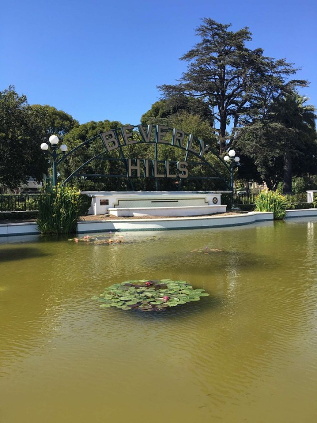
It also has a cactus garden, rose garden, 2 fountains, jogging trails, walking paths, arbors and huge trees!enhanceenhanceAfter the park, we headed to Alfred Tea Room for tea. Alfreds has several locations in LA and 2 in Tokyo. Well, my daughter just had to try their tea this time so off we went.enhanceenhanceWe then headed back to our hotel to get ready for our dinner reservations at The Ivy.

I had made reservations 2-3 weeks prior to leaving for LA and I would highly recommend you do the same. It’s a very popular place…just a warning, it’s not cheap! Book your reservation here.

It is one of the cutest, most colorful restaurant I’ve ever been! The food was delicious and the service was very good. enhanceThe only thing I didn’t like was having to sit so close to other people while I ate..the girl behind my head really didn’t want to be in our pic.

After dinner, we headed back to our apt to pack up and head to Palm Springs. I told my daughter that I would go to LA with her if she would spend one day with me at Joshua Tree National Park. 😉

After much research, I decided it would be best for us to drive there in the evening  hours so we wouldn’t run into all that horrible traffic you hear about in LA. I read the worst times to drive the freeway in LA was from 6 am – 9:30 am and from 3 pm to 7 pm.

So, to avoid having to get up super early, we opted to leave on Tues evening and spend the night in Palm Springs.

It was a 2 hr drive from our hotel in West Hollywood. Thankfully, we didn’t run into any traffic. It was a great decision!

I made reservations for the night at The Saguaro Hotel.

My daughter had talked about staying here because it was so colorful and knew it would be a good place to shoot some pictures. It really was the most colorful hotel I have ever stayed in. It was really cool!

The hotel is actually an old Holiday Inn (originally built as the International in 1977). The Saguaro converted it and opened the hotel under their name in 2012.

enhanceenhanceenhanceenhanceUnfortunately, we arrived so late that we went to bed soon after we checked in.

We woke up early the next morning so we could shoot a few pics of my daughter at the pool before we had to check out and head to Joshua Tree.enhance.jpegAfter we checked out, we headed to the Pink Door. It’s simply a pink door on a personal residence and it’s the only door I know of that has it’s on Instagram page! It’s located at 1100 E Sierra Way.enhanceenhanceAfter having to wait, on who we think was another fashion blogger, we finally got to snap some pictures ….we then headed to find a place to eat breakfast.

We finally settled on MOD Cafe. They had lots of breakfast items to choose from and it wasn’t too expensive. The service and food were excellent! Try a smoothie if you are ever here…they were delicious!

We sat outside and the views were spectacular!enhanceenhanceenhanceWe loved Palm Springs and hated that we didn’t have more time to spend here. There is a lot to do in/around this area. If you ever visit you can check out:

Palm Springs TramPalm Canyon DrRudy’s General Store MuseumCoachellaCoachella Valley PreserveIndian CanyonsPalm Springs WindmillsCheeky’s RestaurantSalvation Mountain (1 hr 45 mins from Palm Springs), The Sandwich SpotTramway Gas StationThe Movie Colony NeighborhoodCabazon DinosaursMarilyn Monroe StatueElvis Presley’s Honeymoon HideawayLiving Desert Zoo & GardensSalton Sea (1 hr from Palm Springs) & Pioneertown.

After breakfast, we headed to a nearby grocery store to pick up snacks and lots of water. I highly recommend you have a full tank of gas, plenty of snacks and lots of water before going into JTNP.

This whole area is very hot and dry. Wear a hat, sunglasses and lots of sunscreen and bring layers…it gets much cooler after the sun sets.

We then headed to Joshua Tree National Park. It was about a 45 min drive from Palm Springs. It was a beautiful drive! We passed the Windmill farm on the way.enhanceenhanceWe finally arrived and entered at what we think was the South entrance. Our GPS had us all turned around so we’re not sure which entrance it was as there are three different ones.

There is a $25 entrance fee per vehicle. enhanceThis park is so different than any other national park I’ve been to…it had a very barren landscape & was full of cacti.

It was very hot and dry and there were huge rocks scattered throughout the park. It was very cool to see those huge Joshua trees!

enhanceenhanceCan you spot the person in the pic above?

We were there in April so we saw a lot of the cacti blooming…enhanceenhanceWe drove through the park stopping along the way until we came to the Barker Dam hiking trail. It’s a very easy, flat 1.2 mi loop trail that leads you to a body of water.

The “dam” was built over a century ago by ranchers to store water for their cattle. It is now a gathering place for wildlife in the park including many species of birds and bighorn sheep.

We didn’t do our research before coming here as we missed the inscriptions on some of the rocks near the top of the dam that read, “Big Horn Dam Built by Willis Keys, W.F. Keyes, Phyllis M. Keys, 1949-1950.”

The Keys took it over in 1949 but it was originally built in the early 1900’s. We also missed an old horse trough and the Petroglyphs. We were unaware that this was a loop trail. So, we just walked to the dam and turned around and went back the way we came.

However, at the end of the trail, right before you head back to the parking lot, there is a sign for the petroglyphs. The main area of the petroglyphs is right behind the sign in a big rock that appears to have a part cut out of it.

I guess this just means that I have to make another trip to the park 😉 I highly recommend you do this hike. The reflections of the rocks in the water were amazing the day we went!enhanceenhance

enhance

enhanceWe then headed to Skull Rock.

It’s located along the main east-west park road and is a favorite stop for park visitors. A parking spot is located just across the road from the rock.

For those wishing to stretch their legs, a 1.7-mile nature trail begins either just across from the entrance to Jumbo Rocks Campgroud or inside the campground, across from the amphitheater.

enhanceenhanceAfter leaving here, we arrived at the Cholla Cactus Garden. We had wanted to stop at the Arch but somehow missed the sign for it.

The cactus garden has a very short and easy 1/4 mi loop trail and I highly recommend you stop here. The concentration of cacti in this area was amazing!enhanceenhanceAfter leaving here, we made it to a different entrance…we stopped and snapped a few pictures before heading back into the park.

We had planned on staying in the park until it was dark as I had read that the stargazing in the park was amazing because it had no light pollution.enhance

enhanceThree months after visiting the park, it was named a Dark Sky Park. Joshua Tree has some of the darkest night skies in the United States.

In July 2017, it was certified as the 10th International Dark Sky Park in the U.S. National Park system. Others include Death Valley, Big Bend and Grand Canyon national parks.

After driving back into the park, we found a place to park. We got out of the car and walked around and took more pictures until it was completely dark.enhanceenhanceenhanceUnfortunately, I didn’t have a camera that would shoot night photography but the sky was absolutely amazing and I had never seen so many stars in my life! I highly recommend you stay in the park to see the stars and possibly the Milky Way.

After leaving the park, we headed back to LA. It was about a 3 hr drive.

The next morning, which was our last full day in LA, we headed to California Donuts for breakfast. It was a 20 min drive from our apt. They were delicious! enhanceenhanceenhanceWe had a full day planned so we needed lots of sugar to keep us going. 😉

We then headed to Venice Beach. We had planned on spending a few hours here before heading to Malibu for dinner.

Tip – Get here early as the parking lot fills up very quickly!

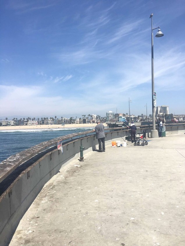
The first thing we did after arriving was walk out to the pier.  There were lots of people fishing at the end of the pier…probably why so many birds were hanging out here too.

enhanceenhanceenhance

enhanceWe then headed to Venice Beach Rentals to rent a bike. I was VERY apprehensive about doing this as I hadn’t ridden a bike in years.

However turns out, It was so easy and fun! It was one of the highlights of the trip for me. The bike path was paved and very flat.

The cost was around $30-35 for an all day rental. You could rent for 1, 2 & 3 hours or all day. We didn’t know how long we would be there so we felt it would be safer to rent all day.

I can’t say this enough, DO IT! It was so much fun…but don’t do it in white pants! At one point, I got off my bike and the very greasy bike chain rested against my pant leg…need I say more?

We rode our bikes down to Santa Monica Pier so we could ride the ferris wheel. We were given a lock and chain with our bike rental so we could keep our bikes chained whenever we had to leave them.

Venice Beach is a very interesting place. It has lots of funky shops, street performers and colorful murals. There’s also a skate park and Muscle Beach Gym. Lots of sketchy people hang out here but we never felt unsafe.

enhanceenhanceenhanceenhanceenhanceI had to pick a bike that matched my outfit. 😉 Seriously though, do I look like I should be riding a bike dressed like this?

After spending a few hours at the beach, we headed to Lemonade for lunch. This was another place my daughter had put on the list to try out.

It’s a “cafeteria style” restaurant with lots of healthy options. They first opened in 2008 and now have 28 locations throughout LA and the surrounding areas.

The restaurant was so bright and clean…it just made you feel good to be here. The food was so good! You have to try their lemonade!enhanceenhanceenhanceenhanceAfter lunch, we headed to 3rd Street Promenade to check out the shops. The area consists of three open-air, car-free blocks that have unique shops, some well known ones and a few restaurants.enhanceenhanceWe then headed back to the car. We were driving to Malibu to spend a few hours there before our 7 pm dinner reservation at Malibu Farm. It was yet another restaurant pick by my daughter.

We made reservations online a couple of weeks prior to leaving for LA and I would recommend you do the same if you plan to eat here.enhanceDriving down the Pacific Coast Hwy headed towards Malibu.

Our first stop was Zuma Beach. It was a beautiful, wide beach with lots of parking. It only cost $6 to park. There were several bathrooms and a snack bar located at this beach. Read reviews hereenhanceenhanceWe didn’t get to spend a lot of time in Malibu so we basically drove around stopping when we saw anything that caught our eye.

After we left Zuma Beach, I spotted wildflowers blooming all over the cliffside.enhanceenhanceWe then headed to the restaurant for our dinner reservation. Malibu Farm is a farm to table restaurant offering locally sourced American cuisine with pier side Pacific views.
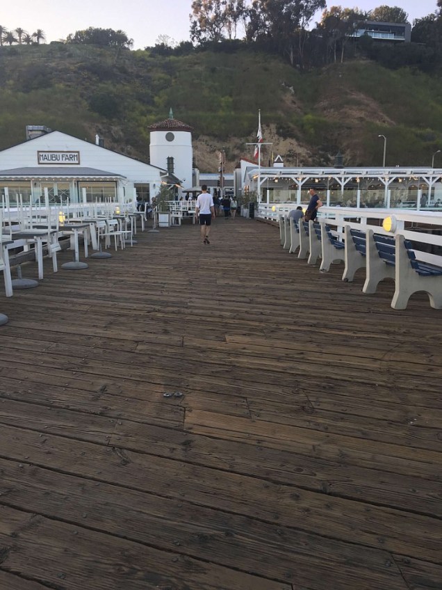
enhanceenhanceI ordered the stoplight tacos trio. They were very good.enhanceMy daughter ordered the grass fed beef burger. She thought it was very good. Check out their menu here and read reviews here.enhanceAfter dinner, we walked out to the pier and enjoyed the views and the sunset.enhanceWe then headed back to West Hollywood..we decided we would have dessert since we had eaten so healthy for dinner. We headed to The Milk Shop.

My daughter had found this place during her research and they had “instagram” worthy desserts so she just had to go. We both ordered an ice cream macaron dipped in fruity pebbles. It was so good!enhanceenhanceenhanceWe then headed back to our apartment and packed. We were flying out the next morning. enhanceLeaving LA enhanceLanding in Las Vegas – we had a layover here. Is anyone else amazed by the landscape views from the airplane?

It amazes me and I take tons of pics from the plane. My hubby loves going through all of our vacation pics! 😉enhanceLeaving Las Vegas and flying over Lake Mead enhanceFlying over the Grand Canyon

Thanks for reading! I hope this helps you plan your own trip to LA, Palm Springs and/or Joshua Tree.


Aruba

Hey guys!

We visited Aruba in Nov 2017 and spent 6 nights on the island.

Tip: Click here to read about entrance requirements for Aruba – the ED card is mandatory for every passenger entering Aruba, including babies and kids, and needs to be filled out and approved. Click here to read about Global Entry.

We had initially booked a trip to Turks & Caicos but after booking our trip there, the island was hit by two hurricanes so we decided to change it to Aruba.

We had never been to either island and after finding out that Aruba was outside of the hurricane belt we felt it was a better option. Thankfully, we had booked our airfare with Southwest  (my favorite airline).

Southwest allows you to change your flight online without a change fee. You only have to pay the difference if the airfare is higher than your originally booked flight.

Our airfare to Aruba ended up costing us an additional $35.

enhanceOur first view of the island

After reading lots of terrible reviews on the car rental places inside the airport, we chose to book with an offsite car rental company called Wheels 2 Go.

I was a little hesitant because I don’t like having to prepay for my car rental..especially with it being an international rental; I wasn’t sure what would happen if I needed to cancel.

They picked us up right outside the airport and the driver took us to our rental car at a parking lot a couple of miles from the airport.

Tip: Read here for tips for navigating the airport

It was definitely a different experience than any rental I’ve ever had before as the car was sitting in some random parking lot and not at an actual rental business. Thankfully, it turned out to be a really good experience and I would definitely recommend them.

We rented a midsize car for 6 nights and the cost was $234.

Tip: Click here for everything you need to know about driving in Aruba & here for the best car rental companies in Aruba

After a lot of research, we decided to stay at the Modern Hotel Aruba. It wasn’t on the beach but we were ok with that since we like to spend most of our time exploring.

We try to find smaller properties when possible as I am not a fan of crowds. This place only had around 7-8 rooms so it was very quiet and we hardly ever saw anyone else there.

We had the Penthouse suite, which is their largest suite. It has a “private” balcony and a huge bathroom with a shower and tub. I would highly recommend this property!

enhanceenhance

This slideshow requires JavaScript.

Read reviews here

You could walk to Palm Beach from our hotel but I wouldn’t recommend it as it would have taken at least 10 mins or more and you had to cross a main road to get there.

I mean who wants to walk in the heat with all of their beach gear and risk getting hit by a car? 😉

Tip – Download the WhatsApp as most everyone in Aruba uses it. We had to use it on 3 separate occasions to communicate with people on the island. Click here for the best Aruba app & here for their food delivery app & here for a self guided tour app

After checking into our hotel, we went to Super Food to pick up a few items. This is a really nice grocery store and it’s huge!

To have your groceries delivered click here & here & for the 3 best grocery stores in Aruba click here

Click here to see a list of all the stores to shop in Aruba

I highly recommend you purchase plenty of water and keep some with you at all times. Aruba is a very hot, dry island and you can quickly become dehydrated. Also, take lots of sunscreen and wear it!!

Tip: For the best reef friendly sunscreens click here and here

We then headed to Oranjestad which is the capital of Aruba to find somewhere to eat. It was about a 20 min drive from our hotel. We ended up eating at Dushi Bagels & Burgers.

I ordered the coconut shrimp and the hubby ordered the usual burger. I wasn’t very impressed with this place. My shrimp tasted like it had little to no coconut on it and my hubby’s burger was too well done. enhance

Read reviews here

After we ate, we walked a very short distance to a nearby beach to watch the sunset. To get there, we had to walk through the Playa Linda Beach Resort’s lobby.

I had read about the spectacular sunsets in Aruba but unfortunately we never saw anything like I had seen in pictures. Still beautiful though!

enhanceenhance

Other nearby beaches in this area include Druif, Palm, Eagle, Hadicurari, Divi, MancheboMalmok, Boca Catalina and Arashi. All of these beaches are within a 10 min drive or less of Dushi Bagels & Burgers.

The next day we had planned on exploring Arikok National Park.

Since we wanted to see the Natural Pool, we had rented a jeep for the day.

Read reviews of the park here

Tip – Do not attempt driving to the Natural Pool without a 4WD and make sure it has good tires and is in good mechanical condition.

You could easily blow a tire and be stranded and a lot of the rental companies don’t cover you if you drive here. There are several tour companies that offer tours if you choose not to drive it.

After researching the best places to rent a jeep on the island, we reserved a jeep with More4Less.

The total cost for the day was $175 for a 4 door jeep. They did have cheaper options available but this is all they had left when I booked.

Tip – Book your jeep before you arrive. They book up quickly!

It was a bit steep but cheaper than booking with a tour co and we got to explore the park on our time.

The rental co picked us up at our hotel at 9 am the next morning and drove us back to their rental location in Oranjestad to pick up our jeep.

After arriving, the process took about 15 mins. While there, they told us about this app called Maps.me and let me just say, it was a lifesaver! It’s a GPS that works off-line so it doesn’t use your data.

Tip: You can download the Airalo app and purchase an Esim card for data – the cost is $9 for 1 GB of data

The island is not easy to navigate. There are very few road signs and lots of roundabouts. This app worked perfectly and never steered us wrong… I highly recommend you download it!

I would highly recommend More4Less…..they were great!

We arrived at the Arikok Ntl Park’s Visitor Center and went in to check it out and to pick up a map of the park. You have to pay an $11 pp entrance fee before entering the park. There are also maps available at the entrance gate which is right beside the visitors center.

Tip- Have plenty of water, a full tank of gas, sunscreen and snacks.

enhanceOur first stop was the beautiful Natural Pool. It took about 30-45 mins to arrive and it was a stressful drive! We drove over so many sharp rocks…I just knew we were going to blow a tire!

You can book a tour to the Natural Pool here.

enhanceenhanceI was so ready to get out of that jeep..I felt like I was going to have some kind of internal injuries after that drive!

Thankfully, it wasn’t too crowded when we arrived. This place is very popular with tourists and can get really crowded during the day so try to get here early or later in the evening. enhanceenhance

This slideshow requires JavaScript.

This place is beautiful….But it can be very dangerous. Please be very careful as there have been deaths in this area.

Tips:

  • The rocks near the water’s edge can be very slippery. I recommend you bring water shoes
  • Never swim outside of the protected pool. The surf and tides can be very dangerous
  • Bring a wet bag for cameras and cell phones because waves crash over the walls of the pool and can get your things wet if you leave them on the rocks.

Read reviews for the Natural pool here

After leaving the pool, we then headed to the Boca Prins Sand Dunes & Beach.

We stopped along the way snapping a few….thousand pics! 😉

enhanceThere were goats all over the park!

enhanceWe first arrived to the Boca Prins Sand Dunes….they looked so out of place.

enhanceenhance
We felt like we had the park to ourselves most of the day as we hardly ever saw anyone else. It was nice to escape the crowds.

We then headed just a short distance to Boca Prins Beach. It was beautiful but it’s definitely not a swimming beach. There are signs warning you not to swim here.

enhanceenhance

This slideshow requires JavaScript.

There is actually a very small restaurant located near here called Boca Prins Bar & Restaurant. – UPDATE: This restaurant is now closed

Our next stop was the Fontein Cave. It’s one of the only caves on the island that has ancient writing on the cave walls. There are park guides that will give you a short tour.

We saw bats flying around in both of the caves that we visited but more so in this one..

Within walking distance of the cave is a small pond where you can sit and put your feet in the water and get a “fish pedicure”..I just had to try it! Don’t be scared..it just tickles!enhanceenhance

This slideshow requires JavaScript.

Tip – This cave doesn’t stay open all day long. It has a gate on it and they close it around 5-6 pm I believe.

Read reviews here

We then headed a short distance to the next cave called Quadirikiri. It’s a lot bigger than Fontein.

You will need to use a flashlight as it’s really dark until you get near the back of the cave where there are holes in the top of the cave that lets light shine through.

enhanceenhance


This slideshow requires JavaScript.

This cave doesn’t close like the Fontein cave.

Read reviews here

Next, we headed to Vader Piet which is simply a wind farm. enhanceWe stopped and took pictures along the way to Baby Beach and spotted this huge red anchor so of course we had to stop and take a pic. 😉

It stands there in memory and in honor of all seamen who have lost their life at sea.

It’s approximately 10 feet 6 inches wide and 15 feet, 6 inches tall.

enhanceAfter being in the heat and desert like conditions all day, we were ready to cool off in the beautiful waters of Baby Beach.

enhanceenhanceWe stayed here to watch the beautiful sunset.

There is food available at this beach. There’s a place that sells just hotdogs and hamburgers and there’s Big Mama Grill where you can order a variety of food items.

The next day, we decided to explore the other side of the island.

But first, we headed to breakfast at Taste of Belgium.

This place was really close to our hotel so we decided to try it out. The food and service was really good. We ate breakfast here twice.

Read reviews here

For the best restaurants that serve breakfast click here

enhanceenhanceAfter breakfast, we headed to the California Lighthouse.

The lighthouse was named after the S.S. California which sank prior to it’s construction in 1910.

The lighthouse is a popular location to watch the sunset.

You can also tour the lighthouse for $10. Purchase tickets here.

There is also an Italian restaurant located here called Faro Blanco. The Faro Blanco Restaurant was once the dwelling of the lighthouse keeper but now serves Aruba and it’s guests the best in Italian cuisine.

Read reviews here

The restaurant has some amazing views if you are seated outside. We never had the chance to try it out.

enhanceenhanceenhanceThe next stop was the Alto Vista Chapel.

Our Maps.me app took us down this very bumpy road that I think may have been meant for 4WD but we made it just fine in our little rental car.

enhanceWe made a few stops along the way before we got to the church. We passed these big boulder fields along the way.enhanceOf course, once we spotted this big black rock that was almost perfectly round, we had to stop and take pics.enhanceenhanceWe finally arrived to the church. I think it took us around 25-30 mins or so to get there from the Lighthouse.

We later found out there was a different route that we could have taken however, I liked the road we took because it was much more scenic.

The church was built in 1750 and reconstructed in 1953. enhanceIMG_0149

Tip: Another church worth visiting is the Lourdes Grotto..it’s a Roman Catholic shrine that was built into the rocks. Read reviews here. It’s located 35 mins from this church in San Nicolas.

In front of the church, there was this little stand selling fresh squeezed lime so we decided to try it out…it was so refreshing!

IMG_0165We then headed to the Donkey Sanctuary .

The sanctuary was founded in 1997 and is a non profit organization ran completely by volunteers.

The donkeys in Aruba were brought to the island over 500 yrs ago as a mode of transportation but as cars were introduced to the island the use for donkeys drastically declined.

They were left to fend for themselves and almost became extinct after an illness killed all but 20. They have now increased in numbers and have a safe place to live. It is free of charge but you can leave a donation.

Read reviews here

enhanceenhanceWe then headed to the Natural Bridge.

The largest and most photographed natural bridge collapsed in 2005. However, it’s still a popular tourist attraction and the baby bridge can also be seen here.

Read reviews here

enhanceenhanceThe collapsed bridge

You can purchase food and drinks here. They mainly sold hotdogs and hamburgers. We ended up eating lunch here and the food was not that good.

Click here for the 10 best restaurants near the Natural Bridge.

IMG_0184We then headed to the Bushiribana Gold Mill Ruins.

The gold mill was built in 1874 during the “gold rush” in Aruba.

Read reviews here

enhanceenhance

This slideshow requires JavaScript.

There is a refreshment stand at the site of the ruins.

Tip: Read here about some hidden gems including a nearby hidden cave pool that you can swim in…AKA Cave pool. Read here about a tour that includes the hidden cave along with the Eyes of God and Black Sand Beach.

We then headed to the Ayo & Casibari Rock Formations. This is a cluster of huge rock formations. They were really cool and best of all, they were free to visit!

There are several short paths you can walk along. There are also stairs that have been built into the rock where you can go all the way to the top for some spectacular views.

Some of the stairs were extremely terrifying because they were so steep!

Rock drawings dating back thousands of years can also be found here.

Read reviews here

enhanceenhanceAt the top, you get an amazing view of Hooiberg It’s a volcanic formation located in the center of Aruba and is the 2nd highest point on the island. You can walk to the top of Hooiberg if you want to walk up almost 600 steps! No thanks!

Read reviews here

The highest point in Aruba is Jamanota, a hill located in the Arikok National Park that stands at 189 meters above sea level.

enhanceWe then headed back to our hotel to get ready for dinner.

After dinner, we headed to Arashi Beach to watch the sunset. This was one of our favorite beaches.enhance

The next day we decided to spend snorkeling and just relaxing at the beach. We went to Boca Catalina.

Unfortunately, our snorkeling experience in Aruba wasn’t that great.

The water was always murky. We did, however, get to see an octopus for the first time.

enhance

enhanceSince the snorkeling wasn’t that good, we decided to go back to Arashi Beach.

The water at Arashi is great for swimming but the snorkeling here is more for advanced swimmers and snorkelers. We didn’t attempt to snorkel here.

We loved this beach…it was never crowded.

enhance

enhanceThe next day, I had surprised my hubby with a couples massage at the  Renaissance Hotel’s private island.

The hotel was located in Oranjestad. It was about a 20-25 min drive from our hotel.

The spa has several different packages you can choose from. I purchased the Caribbean  Morning Couples Package. It included a 50 min massage for two, use of the private spa cove from 9-11:30, use of beach towels and water floats, a fruit tray and 2 drinks each.

Tip: There is an additional charge of $25 per person for non Renaissance guests.

They do offer spa treatments at the hotel as well as the private island. If you stay at the Renaissance, the ferry to the island is free. If you purchase a spa treatment at the island, the ferry is included in the cost.

Tip – The private island is only for the guests of the Renaissance Aruba Resort & Casino. However, if the hotel isn’t at 80% capacity or more, they will sell day passes for $125 for adults & $62.50 for children ages 5-12 (price includes lunch)but you have to either call or go to the hotel on the day you want to visit to check for availability because I don’t think they sell advanced tickets. Read all about how to get to the island here.

I would recommend if you want to visit the island, that you either book your entire stay at the hotel, book at least one night at the hotel or book a spa treatment.

I can’t say this enough, if you go to Aruba, you need to go here!! It was truly the highlight of our trip! It’s a 40-acre private tropical retreat with white sand beaches and crystal clear waters and it is beautiful!

Read reviews here

Our massage was at 9 am but we had to check in at the spa inside the hotel at 8 am. The only place to park was across the street from the hotel. After we checked in, we had to walk back across the street to catch the ferry.

Tip – If you stay at the hotel, the ferry picks you up inside the hotel…very cool.

The ferry runs every 15 mins … It’s a 8 min ferry ride to the island. One side of the island is for families and one side is for couples.

As some of you may know, there are 6 beautiful flamingos that reside on the island and you can feed them right on the beach.

Tip: De Palm Island also has flamingos  – click here to see how to get to the island & here on a detailed blog post about the island

We arrived about 30 mins before our massage so we spent some time feeding and taking pics of them. Flamingos can only be found on this island and nowhere else in Aruba.

enhanceenhanceTip– I recommend if you book a massage that you book the earliest time available to beat the crowds that are all fighting to get their pic made with the flamingos. There was hardly anyone there when we arrived.

We then walked over to our BEAUTIFUL private bungalow right on the water to prepare for our massage. The therapists were already there waiting on us.

enhance

enhanceThey explained what we needed to do and then walked outside so we could shower off and get on the massage tables.enhance

Tip– Make sure you have NO sand on you when you get ready for your massage or you may not have a pleasant experience.

Unfortunately, I still had a little sand on my feet and even though the therapist tried dusting it off, not all of it came off and I could definitely feel it when she began the massage.

This could have been prevented if they would have started the massage with my back and not my feet. I’ve never had a massage where they started with my feet.

I was a little worried about booking this for my hubby because he had never had a massage before but he ended up loving it and said he needed to start having more of them!

This slideshow requires JavaScript.

There were lots of private little bungalows all over the island and I’m not sure if it was first come, first serve or if you had to reserve them through the hotel. There were also hammocks randomly placed throughout the island.

enhanceenhanceThis was a splurge for us because we were celebrating our 29th yr wedding anniversary but I loved it so much that I would definitely pay to do it again even if it wasn’t a special occasion!

Tip – You can actually book a dinner under the stars on the island even if you aren’t a guest of the Renaissance hotel. The dinner is served on the beach every Wed at 7 pm. The cost is $65 for adults and $33 for children ages 5-12.

After leaving our private bungalow, we headed to the Papagoyo Bar & Grill for lunch. I ordered the grouper sandwich and the hubby ordered his usual burger. The food and service was great!

You couldn’t beat the views either!

After lunch we walked around the island.

Not only did the island have flamingos, but it also had tropical fish and iguanas.

After spending ½ the day here, we ferried back over to Oranjestad. I had also surprised my husband with a 5 hr private sailing tour that included dinner, snorkeling and a sunset with the Morning Star.

I had read rave reviews about it and decided to book it before we left on our trip.

Unfortunately, the weather had been calling for rain that day and sure enough it had rained quite a bit in Oranjestad but thankfully not on the private island.

Sadly to say, I received a text message from the owner of the boat canceling the tour due to the weather. Aruba is usually a very windy island but they had been having very little wind.

So, on top of the rain and no wind she felt it was in our best interest to cancel. Needless to say, I was VERY disappointed.

So, we ended up staying in Oranjestad and walked around checking out the shops & outside marketplace. enhanceenhance


Tip – Click here and see how many cruise ships will be in port each day. You can then avoid the crowds.

We then headed to Mangel Halto Beach just to check it out.

This is supposed to be a great snorkeling area but we never snorkeled here. It was really beautiful and the water was really calm and clear.enhanceenhanceRead reviews here

Later, we headed to Savaneta to eat dinner at Zeerovers.

We had tried to eat here earlier in the week but they were closed.

We later found out that the only day they close is Mon. This is a seafood place and they only sell whatever fish was caught that day.

This place gets very busy so I would recommend you get here early. It’s a very popular place with tourists and locals.

You order your food at a small window as soon as you walk into the restaurant. After paying, they hand you a number and then you go find a table.

They sell a variety of fish but you never know what kind it will be. It could be grouper, red snapper, amberjack etc. It’s usually more than one kind.enhanceThey also sell shrimp. You have to tell them how many pounds you want of each(if you want both). The guys that took our order were good about gauging the weight based on the number of people you were ordering for.

They weigh it, put it in a bag and then it all gets cooked together…everything is fried. It’s served with fries. They also have plantains and cornbread.

Make sure you order the tartar sauce…it was so good!

Tip – They only take cash.

The food was really good but VERY messy…be prepared to get your fingers dirty!

Read reviews here

enhanceenhanceWe sat at a table right beside the water and as we were waiting on our food, the local fishermen pulled up in their boats to drop off their catch of the day. enhanceenhanceFunny story…after dinner, we went to leave but then decided to walk down beside the restaurant to take a picture of the sunset. There was a house beside the restaurant that, unbeknownst to us, was the house of the restaurant owner’s sister.

She came out and started talking to us…She then invited us to come into her house where she began telling us that it was the house she was raised in. She was probably in her 70’s. Well, then one of her brothers walks up and joins in on the conversation.

He then takes us over to his house, which was next door, and introduces us to his wife. He is also a swim coach in Aruba and trains kids for the olympics. His name was Roly Bisslik.

His sister then asked us to stay for coffee but we told them we had to get going. It was such a neat experience. They were such a sweet family.

We should have stayed because we ended up stopping at the Hub Coffee & Juice Bar. The coffee was really good and I’m picky about coffee.

The next day was our last full day in Aruba. We really didn’t have anything planned but when we woke up that morning it was pouring rain.

We decided to get out and ride around. We knew the rain probably wouldn’t last long. We headed to Eagle Beach. It’s been voted the 2nd best beach in the Caribbean and the 3rd best beach in the world!

It’s also home to two of the most photographed and renowned fofoti trees in Aruba.

My husband apparently thought he could fly… 😉enhanceenhanceWe then ended up driving to the Bubali Bird Sanctuary.

It wasn’t easy to find and we drove around in circles for a while.

Read reviews here

IMG_0325IMG_0310We saw about 4-5 different types of birds along with a turtle. There’s an observation tower you can climb for better views but we didn’t climb it.

After we left here, we noticed this place right on the side of the road that looked like it had shells. So, we pulled over and got out. The place was covered in coral and shells!

It’s located just north of the windsurfing area. You can see an old rusted out ship sticking out of the shallow water.

enhance

enhance


We then headed out to find lunch.

We came across a place right on the water and decided to give it a try. It was called The West DeckenhanceWe first ordered the grouper fingers and the fried funchi (similar to corn bread) with dutch cheese. The menu said it was a “must on the Aruban table” so we had to try it. Both were delicious!

enhanceWe then ordered the fish sandwich….it was so good! We both agreed that this was one, if not the best, meal we had in Aruba.

The service was excellent …very friendly people. I can see why they call Aruba “one happy island”…everyone seemed happy and were all very friendly.

enhance
After we ate, we headed to a nearby beach to spend the rest of our day and hoped to see a beautiful Aruban sunset.

Sadly, once again, it was cloudy and we never got to witness that big orange ball sinking into the sea. However, every sunset in Aruba is beautiful. enhanceMy hubby is a burger connoisseur …he loves burgers and always researches the best place to get one anytime we go anywhere. So, during his research, he came across this place called Juanchis Burger.

So, for dinner that evening, that’s where we headed. It was located very close to our hotel in the Palm Beach Plaza Mall.

We both ordered the baby portobello burgers with an order of fries sprinkled with a garlic parmesan cheese. The burgers were awesome! So good! enhanceenhance

enhanceRead the reviews on this restaurant here. UPDATE: This place is now closed.

After dinner, we headed back to our hotel and called it a night….sadly, we would be flying out the next day.

The next morning, we headed back to Taste of Belgium for breakfast.

This place is also located in the Palm Beach Plaza Mall.

We then headed back to the hotel to pack up. We checked out of the hotel around 11 am.

We had a few hours to spend on the island before our plane departed.

So, we decided to drive back down to Eagle Beach. It was about a 10 min drive from our hotel.

When we arrived, there was this amazing dark cloud in the sky. It made for some great shots.enhanceenhanceenhanceAfter spending some time here, we headed out…but about that time, I told my husband that it looked like a water spout was forming. I had never seen one in person so I was really hoping that’s what was happening.

Sure enough, by the time we got parked again, one had formed! It was so cool to actually see it in person!

enhanceI only had time to snap a few pictures with my iPhone before it dissipated so the quality isn’t the best.

It was a great way to end our time in Aruba!

We then headed back to the parking lot where we had initially picked up our rental car. The rental company was meeting us there so we could drop off the car and then they were going to drop us off at the airport.

We had a great time in Aruba and I highly recommend you visit this beautiful island.

enhanceGoodbye Aruba..it was fun!!

Click here to see links to all of my blog posts

Other things to do while you are there::

Every Tue they hold what’s called a Bon Bini Festival in the outer courtyard of the historical museum near Ft Zoutman.  You can also climb the stairs of the fort for 360 degree views.

Shopping – Seaport Marketplace Mall and Seaport Village click here for more

Sea glass Tour

Wilhelmina Park – lots of lizards hanging out

De Palm Island – Aruba’s only all-inclusive destination offering something for everyone! Enjoy body drop slides, a kids waterpark, snorkel tours, an underwater helmet walk, banana boat rides, beaches, and more. – Read reviews here

Ostrich Farm  – read reviews here

Butterfly Farm – read reviews here

Behind the boat docks in downtown, fishermen can be seen cleaning their catch of the day. You can also see large pelicans near the yacht slips.

Eagle Beach – most popular and widest beach & home to 2 world renowned Fofoti Trees

Palm Beach – pretty but crowded and not good for snorkeling

For a complete list of photographers in Aruba click here

For a luxury picnic on the beach click here

For a list of events in Aruba click here

For the best spas click here

Street Art in San Nicolas

St Ann’s Catholic Church

Philips Animal Garden – Read reviews here

Kukoo Kunuku Party Bus – Read reviews here

The Trolley – The trolleys offer free transportation to and from the main street downtown area in a loop with the cruise ship terminal. The streetcars can be boarded right outside the cruise port’s main gate.

Click here for 72 fun things to do in Aruba & here for 25 more things to see/do

Best snorkeling beaches: Arashi, Boca Catalina (small bay in the Malmok beach area), Catalina Cove (close to Boca Catalina – you have to enter the water at Boca then swim north – swim along the edge of the coves to see fish). Baby Beach – warning: the currents can be strong here, Mangel Halto – 4 star snorkeling but must be a good swimmer – located in the city of Savaneta. Tres Trapi – next to Catalina Cove(has 3 steps in the rocks to get into the water – apparently lots of colorful starfish here). We checked out Tres Trapi and there is no way I would have gotten in the water here….the water was very rough. Maybe it’s usually calm but not the day we went.enhance

Click here for top 10 beaches in Aruba

Click here for best restaurants in Aruba

Click here for the 10 best wedding venues

Click here for most romantic things to do in Aruba

Click here & here for most popular tours in Aruba

Click here for most popular hotels in Aruba

Click here for best things to do with children

Click here & here for very useful Tips for traveling to Aruba for the first time

Click here to find out about 3 hidden gems in Aruba that most don’t know about

Click here for 16 facts that may surprise you about Aruba

Click here for a list of all the beaches in Aruba shown on a map

Click here for 13 things to know before you visit Aruba

Click here for 14 things NOT to do in Aruba

My own suggestions for romantic things to do: Watch the sunset at the lighthouse, book a private dinner on the beach, book a couple’s massage on the beach, take a stroll on the beach during sunset, book a private sunset cruise, have breakfast/dinner delivered to your room & stay in, have a picnic in a secluded area or on the beach during sunset, take a horseback ride on the beach or take a midnight swim in the pool..I would say ocean but I’m terrified of sharks so I can’t recommend! 😉

Thanks for reading. I hope this helps you plan your own trip to Aruba!

If you have any ideas or suggestions, please feel free to leave a comment.